Mesoscale Discussion 1050
Issued: · Valid: –
Summary
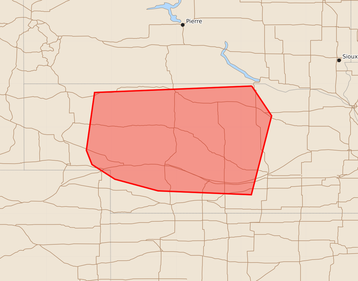
Severe storms capable of producing large hail, damaging winds, and tornadoes are expected to impact portions of central Nebraska this evening. The tornado threat is forecast to increase as these storms move through the area.
Product Text
000 ACUS11 KWNS 092217 SWOMCD SPC MCD 092216 NEZ000-COZ000-092315- Mesoscale Discussion 1050 NWS Storm Prediction Center Norman OK 0516 PM CDT Tue Jun 09 2026 Areas affected...portions of central Nebraska Concerning...Severe potential...Watch likely Valid 092216Z - 092315Z Probability of Watch Issuance...80 percent SUMMARY...A WW will be issued shortly for portions of central Nebraska. Hail and damaging winds are likely initially but the tornado threat is expected to increase into the evening. A WW will be issued by 23z DISCUSSION...As of 22 UTC, visible and radar imagery showed convection intensifying over the western NE Panhandle. The environment downstream has recovered quickly in the wake of earlier clouds while maintaining robust surface moisture with dewpoints in the upper 60s, increasing to the low 70s F farther east. A very unstable environment (MLCAPE 3000-4000 J/kg) is in place with deep-layer shear supportive of organized supercells. The ongoing storms should continue to mature with a mixed/cluster supercell mode expected to spread eastward. Hail and damaging winds are likely with supercells initially where higher cloud bases are expected. However, as storms move into the richer moisture, backed low-level flow will support a tornado risk. This may increase further this evening as a forecast 40+ kt low-level jet expands low-level hodographs. ..Lyons/Smith.. 06/09/2026 ...Please see www.spc.noaa.gov for graphic product... ATTN...WFO...OAX...GID...LBF...BOU... LAT...LON 42959875 42269829 40439876 40520092 40790192 41130245 41460258 42800239 42959875 MOST PROBABLE PEAK TORNADO INTENSITY...100-125 MPH MOST PROBABLE PEAK WIND GUST...65-80 MPH MOST PROBABLE PEAK HAIL SIZE...2.00-3.50 IN