Mesoscale Discussion 1765
Issued: · Valid: –
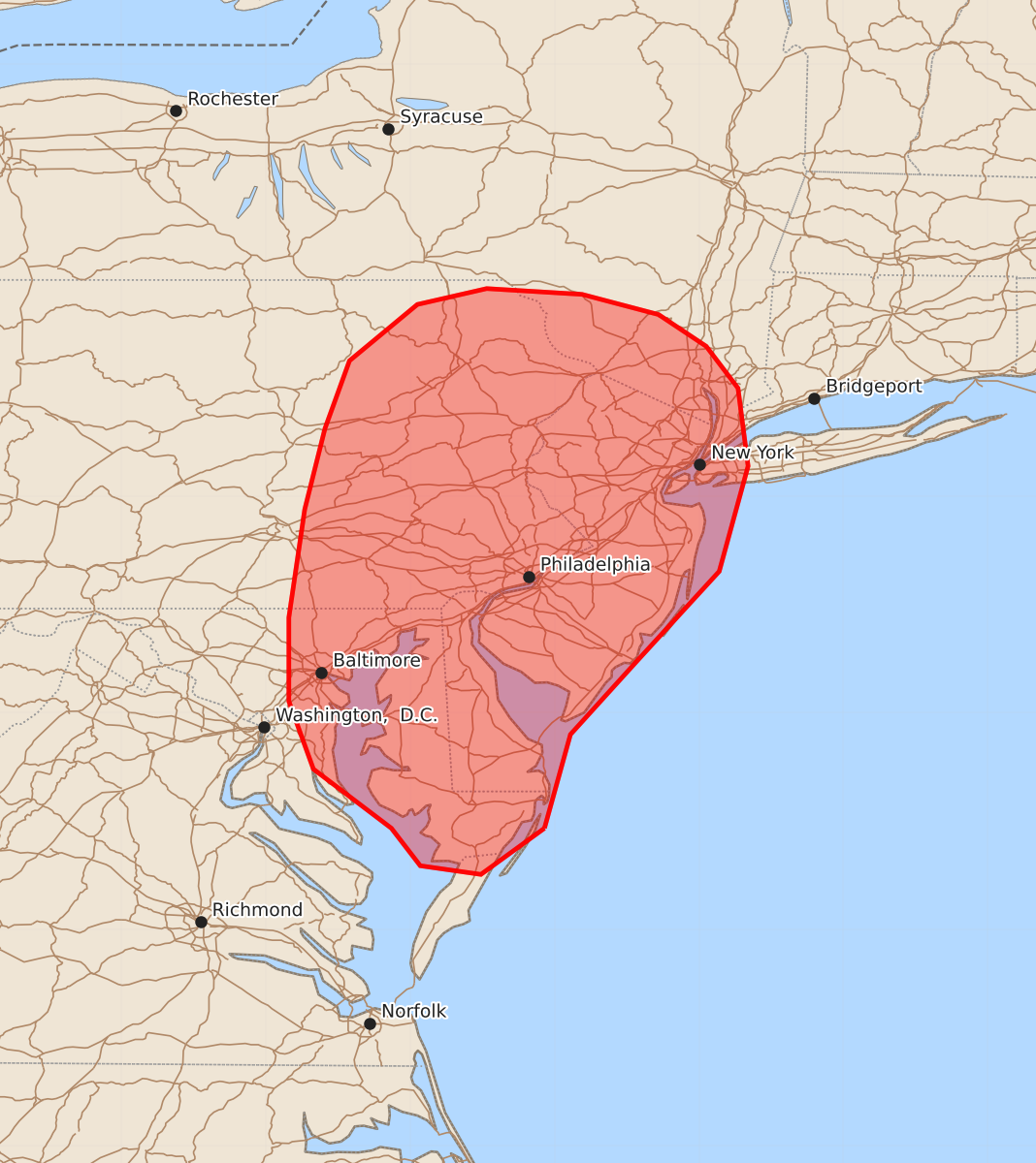
Summary
Damaging downburst winds are possible across parts of the Mid-Atlantic through late afternoon today. These storms may produce wind gusts up to 60 mph.
Product Text
000 ACUS11 KWNS 271812 SWOMCD SPC MCD 271811 CTZ000-NYZ000-NJZ000-PAZ000-MDZ000-DEZ000-VAZ000-272015- Mesoscale Discussion 1765 NWS Storm Prediction Center Norman OK 0111 PM CDT Mon Jul 27 2026 Areas affected...Parts of the Mid-Atlantic Concerning...Severe potential...Watch unlikely Valid 271811Z - 272015Z Probability of Watch Issuance...5 percent SUMMARY...The potential for damaging downburst winds should increase through late afternoon as thunderstorm coverage increases across portions of the Mid-Atlantic. DISCUSSION...Convection has been percolating across the greater Mid-Atlantic region from late morning through early afternoon. While much of this activity has been fairly shallow and transient so far, a few stronger cores have briefly pulsed to near severe limits before decaying. Weak deep-layer wind shear will continue to modulate overall storm intensity and longevity; however, steady diurnal heating through broken cloud cover has allowed temperatures to warm into the 80s and low 90s within a somewhat moist air mass. This heating/mixing has allowed low-level lapse rates to increase to around 8 to 8.5 C/km, which is favorable for strong downbursts capable of producing damaging winds (most likely 40-60 mph). GOES imagery shows several deepening towers and cumulus clusters, hinting that thunderstorm coverage will continue to increase - especially along a subtle surface trough/weak front draped across the region. The potential for damaging gusts should increase in tandem with thunderstorm coverage, but the overall threat should remain sufficiently localized and transient to preclude watch issuance. ..Moore/Hart.. 07/27/2026 ...Please see www.spc.noaa.gov for graphic product... ATTN...WFO...OKX...ALY...PHI...BGM...AKQ...CTP...LWX... LAT...LON 38207507 37887551 37947593 38207613 38617667 39087684 39667684 40417673 40977659 41447642 41837595 41947547 41907481 41767428 41547395 41257373 40717366 39987386 39387441 38857489 38207507 MOST PROBABLE PEAK WIND GUST...UP TO 60 MPH