Mesoscale Discussion 1494
Issued: · Valid: –
Summary
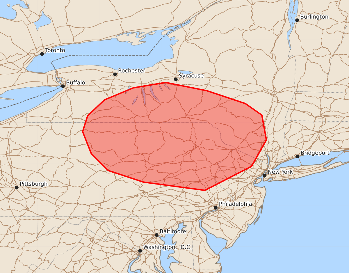
Severe thunderstorms capable of producing damaging wind gusts are expected across portions of southern New York, northern New Jersey, and north-central to northeast Pennsylvania this afternoon. These storms may produce wind gusts between 55 and 70 mph.
Product Text
000 ACUS11 KWNS 041906 SWOMCD SPC MCD 041905 NYZ000-NJZ000-PAZ000-042130- Mesoscale Discussion 1494 NWS Storm Prediction Center Norman OK 0205 PM CDT Sat Jul 04 2026 Areas affected...Portions of southern NY...north-central/northeast PA...and northern NJ Concerning...Severe potential...Watch likely Valid 041905Z - 042130Z Probability of Watch Issuance...80 percent SUMMARY...The area is being monitored for an increasing risk of severe thunderstorms this afternoon. The primary concern is damaging wind gusts. A watch is likely. DISCUSSION...The latest visible satellite imagery indicates an east/west-oriented band of deepening boundary-layer cumulus across northern PA -- within a zone of broadly confluent low-level flow. Thunderstorms should continue increasing in coverage and intensity within this zone over the next few hours, given ample diurnal heating/destabilization of a moist air mass (upper 60s to lower 70s dewpoints). Steepening low-level lapse rates and around 30-40 kt of unidirectional shear should promote several organized clusters capable of producing scattered damaging wind gusts through the afternoon. An additional focus for severe thunderstorms is evident downstream of Lake Ontario, where an MCV and related thunderstorms will continue eastward into the diurnally destabilizing air mass. These storms will also pose a risk of damaging wind gusts as they intercept the unstable air. ..Weinman/Hart.. 07/04/2026 ...Please see www.spc.noaa.gov for graphic product... ATTN...WFO...OKX...ALY...PHI...BGM...BUF...CTP... LAT...LON 42977639 42777539 42467446 42187406 41587395 40947431 40367544 40567693 40847778 41257819 41787840 42167828 42557787 42847717 42977639 MOST PROBABLE PEAK WIND GUST...55-70 MPH MOST PROBABLE PEAK HAIL SIZE...UP TO 1.25 IN