Mesoscale Discussion 1049
Issued: · Valid: –
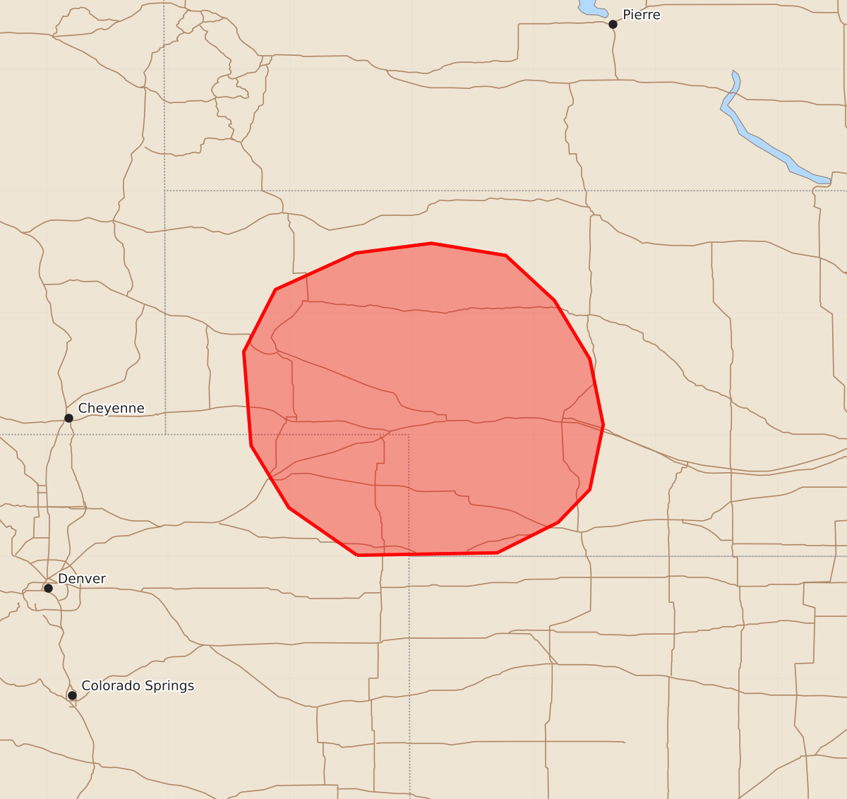
Summary
Severe thunderstorms capable of producing damaging wind and large hail may develop across far northeast Colorado and western Nebraska this afternoon.
Product Text
000 ACUS11 KWNS 092031 SWOMCD SPC MCD 092031 NEZ000-COZ000-092200- Mesoscale Discussion 1049 NWS Storm Prediction Center Norman OK 0331 PM CDT Tue Jun 09 2026 Areas affected...portions of far northeast Colorado into western Nebraska Concerning...Severe potential...Watch possible Valid 092031Z - 092200Z Probability of Watch Issuance...60 percent SUMMARY...The threat for severe wind and hail should gradually increase as developing storms move off of the higher terrain and ingest greater moisture/buoyancy. A Severe Thunderstorm Watch may eventually be issued. DISCUSSION...NLDN lightning data and visible satellite depict an ongoing thunderstorm across far northeast CO, with hints at CU tops breaching a cirrus cloud deck. A mid-level longwave trough is beginning to overspread the High Plains as surface temperatures reach the 85-90 F range, indicating adequate lift to support at least scattered thunderstorm development. Dewpoints are approaching the mid to upper 60s F in western NE, with MLCAPE ranging from 1000-3000 J/kg, progressing from far northeast CO into western NE. The well-mixed boundary layer in place may support severe storms given 30-40 kts of effective bulk shear and 8.5+ C/km mid-level lapse rates aloft. Any storms that develop will accompanied by a threat for severe wind and hail. Since the storms will likely develop west of the moisture axis, it is unclear when storms will experience an appreciable uptick in intensity. Nonetheless, a Severe Thunderstorm Watch issuance may eventually be needed. ..Squitieri/Mosier.. 06/09/2026 ...Please see www.spc.noaa.gov for graphic product... ATTN...WFO...LBF...GLD...BOU...CYS... LAT...LON 40010245 40400301 40910332 41680338 42190312 42490246 42570184 42470123 42100083 41620054 41080043 40550054 40280080 40030130 40010245 MOST PROBABLE PEAK TORNADO INTENSITY...UP TO 90 MPH MOST PROBABLE PEAK WIND GUST...65-80 MPH MOST PROBABLE PEAK HAIL SIZE...1.50-2.50 IN