Mesoscale Discussion 1589
Issued: · Valid: –
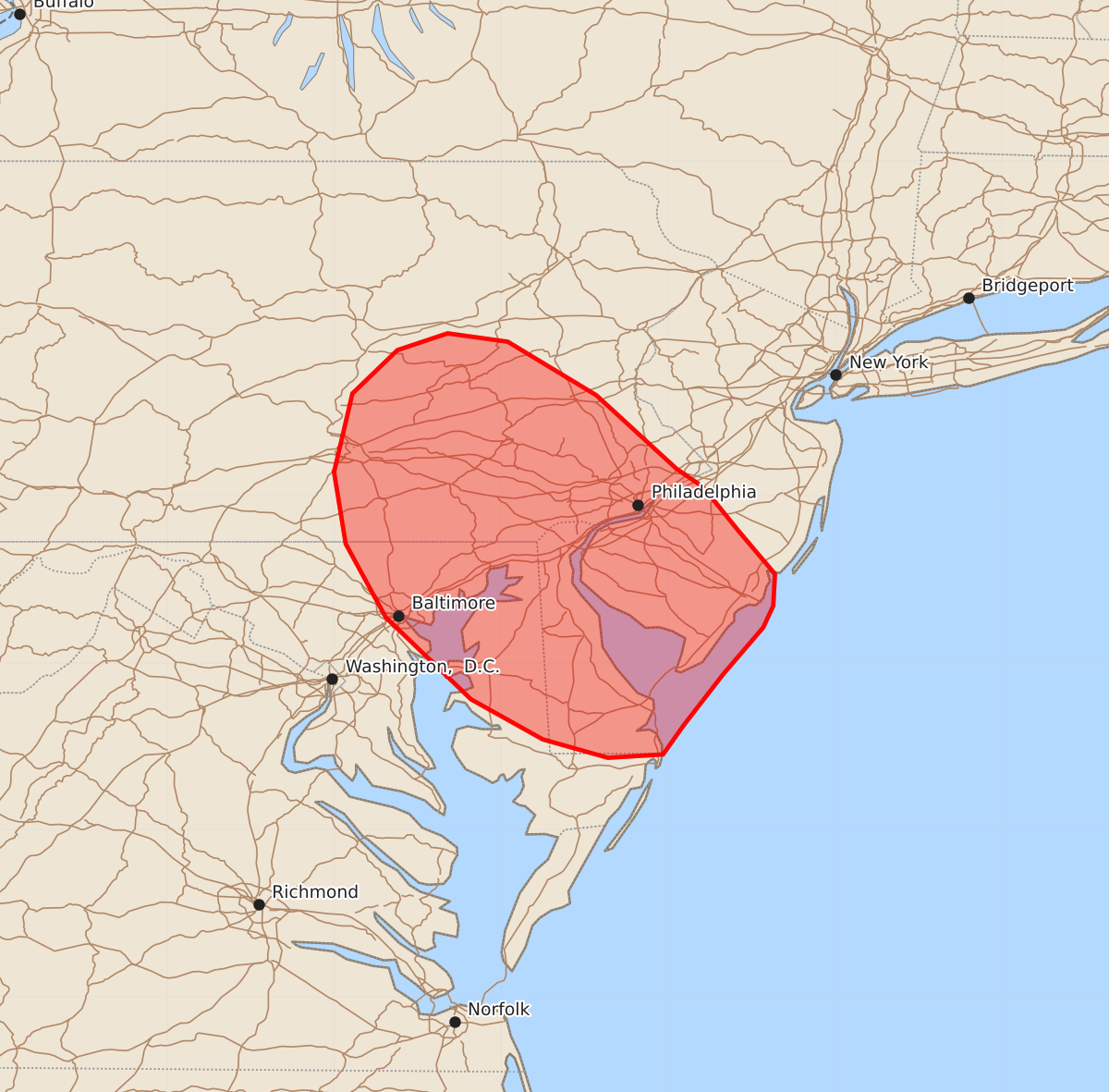
Summary
Widely scattered thunderstorms may bring isolated damaging wind gusts and marginally severe hail to portions of the Mid-Atlantic through this evening.
Product Text
000 ACUS11 KWNS 111856 SWOMCD SPC MCD 111856 NJZ000-PAZ000-MDZ000-DEZ000-112100- Mesoscale Discussion 1589 NWS Storm Prediction Center Norman OK 0156 PM CDT Sat Jul 11 2026 Areas affected...portions of the Mid-Atlantic Concerning...Severe potential...Watch unlikely Valid 111856Z - 112100Z Probability of Watch Issuance...5 percent SUMMARY...Widely scattered thunderstorms may bring a risk for isolated damaging wind gusts and perhaps an instance of marginally severe hail to portions of the Mid-Atlantic through this evening. DISCUSSION...Widely scattered thunderstorms developing along a west-east oriented cold front are expected to progress southward across portions of the Mid-Atlantic this afternoon amid a warm, moist low-level air mass. While poor mid-level lapse rates (5.5 C/km or less sampled by the IAD 12z observed sounding) are largely limiting the magnitude of available buoyancy to around 1000 J/kg, latest objective analysis suggests that localized pockets of up to 1500 J/kg may exist across this region. Concurrently, modestly stronger mid-to-upper level flow is overspreading the region ahead of an approaching mid-level shortwave trough, which is contributing to 25-35 kts of effective shear. This may support some organization of thunderstorms, including the potential for transient supercell structures. While the overall thermodynamic environment remains rather limited, the aforementioned combination of buoyancy and shear coupled with modestly steep low-level lapse rates may support isolated damaging winds and perhaps an instance of marginally severe hail through this evening. Given the expectation for severe magnitude/coverage to remain limited, watch issuance is not anticipated at this time. ..Chalmers/Smith.. 07/11/2026 ...Please see www.spc.noaa.gov for graphic product... ATTN...WFO...PHI...BGM...AKQ...CTP...LWX... LAT...LON 38937467 38627491 38457503 38437536 38547575 38787618 39277669 39717693 40147700 40617689 40877662 40977632 40927596 40607543 40167495 40057479 39797458 39537436 39347437 39217443 38937467 MOST PROBABLE PEAK WIND GUST...UP TO 60 MPH MOST PROBABLE PEAK HAIL SIZE...UP TO 1.25 IN