Mesoscale Discussion 1615
Issued: · Valid: –
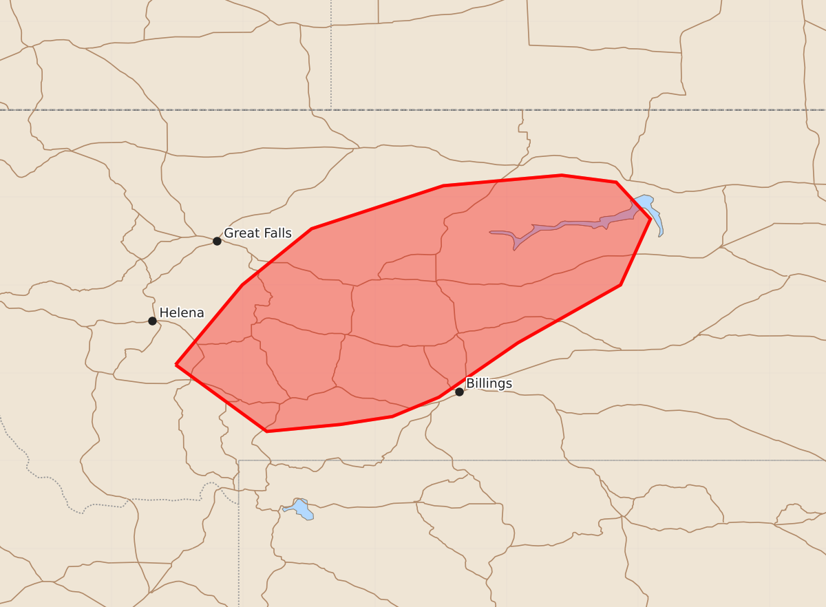
Summary
Scattered thunderstorms are expected to develop across portions of central Montana during the evening of July 14, potentially bringing severe wind gusts and occasional hail.
Product Text
000 ACUS11 KWNS 142223 SWOMCD SPC MCD 142222 MTZ000-142345- Mesoscale Discussion 1615 NWS Storm Prediction Center Norman OK 0522 PM CDT Tue Jul 14 2026 Areas affected...portions of central Montana Concerning...Severe potential...Watch possible Valid 142222Z - 142345Z Probability of Watch Issuance...60 percent SUMMARY...Scattered thunderstorms should develop over the next few hours, posing a severe gust threat. A WW issuance may be needed pending greater storm coverage. DISCUSSION...Hints at convective initiation (via the detection of lightning with NLDN data) are underway along the eastern fringe of a cloud shield overspreading the northern Rockies in association with a 500 mb wind maximum grazing central MT. Here, surface temperatures are approaching 95 F amid mid 50s to lower 60s F surface dewpoints, yielding over 1000 J/kg MLCAPE. 30+ F surface temperature/dewpoint spreads are in place, with RAP forecast soundings showing an appreciably mixed boundary layer extending up to at least 700 mb. As such, if the mixing boundary layer can support the initiation of additional storms over the next few hours, evaporative cooling potential should be sufficient to support severe gusts with the heavier storm cores. An instance or two of severe hail also cannot be ruled out. A Severe Thunderstorm Watch issuance may be needed if/when greater storm coverage becomes clearer. ..Squitieri/Smith.. 07/14/2026 ...Please see www.spc.noaa.gov for graphic product... ATTN...WFO...BYZ...GGW...TFX... LAT...LON 46091177 47001101 47641022 48130872 48250737 48170675 47750636 47000670 46340787 45720877 45500930 45410989 45331073 46091177 MOST PROBABLE PEAK WIND GUST...65-80 MPH MOST PROBABLE PEAK HAIL SIZE...UP TO 1.25 IN