Mesoscale Discussion 1438
Issued: · Valid: –
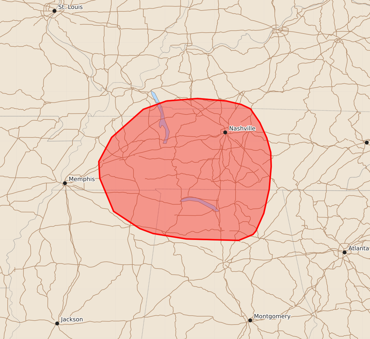
Summary
Severe thunderstorms capable of producing damaging wind gusts are possible across middle Tennessee and northern Alabama this afternoon. The expected wind gusts may reach speeds of 55 to 70 mph.
Product Text
000 ACUS11 KWNS 021717 SWOMCD SPC MCD 021716 TNZ000-ALZ000-KYZ000-MSZ000-021945- Mesoscale Discussion 1438 NWS Storm Prediction Center Norman OK 1216 PM CDT Thu Jul 02 2026 Areas affected...Middle Tennessee into northern Alabama Concerning...Severe potential...Watch possible Valid 021716Z - 021945Z Probability of Watch Issuance...40 percent SUMMARY...A severe thunderstorm watch is being considered for Middle Tennessee into portions of northern Alabama this afternoon in anticipation of thunderstorms capable of damaging wind gusts. DISCUSSION...Based on the 12Z OHX sounding and current surface observations, surface heating is beginning to reach and exceed convective temperatures across much of the Southeast. Visible satellite trends show a cumulus field increasing in both extent and depth, and HRRR-based mesoanalysis shows MLCINH effectively gone across much of Middle Tennessee into northern Alabama. While convective activity has yet to develop, the expectation is that convective initiation should occur by mid-afternoon. Given steep mid-level lapse rates from the 12Z OHX sounding (a new daily max record of 7.5 C/km), modest precipitable water content of 1.72 in, and generally weak flow aloft, thunderstorms will be capable of intense downdrafts with strong to severe wind gusts. While the upper flow generally doesn't support convective organization, storms may organize along outflow boundaries that will pose locally higher risks for damaging winds. Conditions will continue to be monitored for a severe thunderstorm watch this afternoon. ..Halbert/Hart.. 07/02/2026 ...Please see www.spc.noaa.gov for graphic product... ATTN...WFO...LMK...OHX...BMX...HUN...PAH...MEG... LAT...LON 36818797 36868734 36818676 36748646 36658627 36378608 36068594 35778586 35488585 35028589 34538600 34178616 34108622 33988651 34018757 34128824 34228851 34578904 35248932 35588934 36078908 36648844 36818797 MOST PROBABLE PEAK WIND GUST...55-70 MPH MOST PROBABLE PEAK HAIL SIZE...UP TO 1.25 IN