Mesoscale Discussion 1266
Issued: · Valid: –
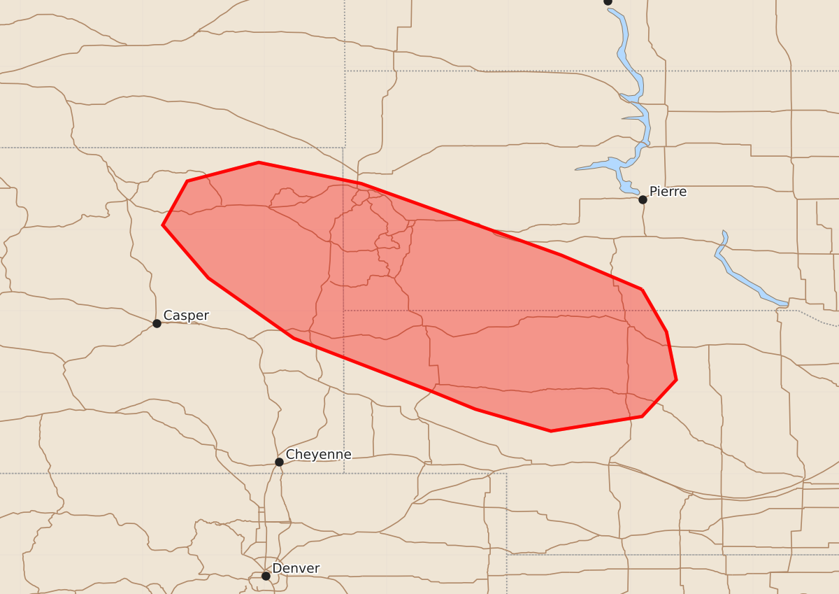
Summary
Thunderstorms capable of producing isolated large hail and increasing wind threats will continue through the overnight hours across eastern Wyoming, southwest South Dakota, and northwest to north-central Nebraska. Damaging wind gusts of 55 to 70 mph and hail up to 1.75 inches are possible during this period.
Product Text
000 ACUS11 KWNS 230444 SWOMCD SPC MCD 230444 NEZ000-SDZ000-WYZ000-230645- Mesoscale Discussion 1266 NWS Storm Prediction Center Norman OK 1144 PM CDT Mon Jun 22 2026 Areas affected...eastern Wyoming...southwest South Dakota...and northwest into north-central Nebraska Concerning...Severe potential...Watch unlikely Valid 230444Z - 230645Z Probability of Watch Issuance...20 percent SUMMARY...Thunderstorms will continue this evening across eastern Wyoming, southwest South Dakota, and northwest into north-central Nebraska. Isolated large hail will be possible in the short term, with an increasing wind threat perhaps evolving overnight. A watch is not likely in the short-term, but the region will be monitored for a watch overnight. DISCUSSION...Thunderstorms are developing or re-intensifying this evening across the highlighted area. A report of 1.5" hail was received around 10 PM MDT this evening across Oglala, South Dakota. Examination of model soundings indicates a largely uncapped atmosphere across the area. Evaluation of objective analyses suggests broad warm-air advection centered on the 700-millibar layer is likely contributing to the broad, large-scale ascent across the area. MUCAPE values have waned from earlier this evening, with current values locally around 1000-1500 J/kg and most areas having less. Effective-layer shear remains greater than 50 knots across much of the area, largely owing to the southeasterly low-level flow and the broad westerly mid-level flow. These thunderstorms should continue to percolate this evening into the morning hours as they generally move east-southeast. Mid-level lapse rates have weakened a bit from earlier today, with only around 7 C/km estimated from model soundings from the RAP analyses. This would indicate a more limited potential for large hail, however, very long, straight hodogaphs will support supercellular storm modes with dynamic pressure perturbations within the mesocyclone augmenting ascent and supporting a continued threat for hail. Latest high-resolution guidance suggests that these thunderstorms will grow upscale later this evening, organizing into one or more mesoscale convective systems. As this occurs, an increase in damaging wind potential may increase, as DCAPE values are on the order of 500-1000 J/kg. The need for a watch should remain rather limited in the near term given the small spatial/temporal scales of any large hail threat. The need for a watch later tonight remains less certain owing to differences in the guidance regarding any upscale evolution into an MCS. The area will continue to be monitored. ..Marsh/Smith.. 06/23/2026 ...Please see www.spc.noaa.gov for graphic product... ATTN...WFO...LBF...UNR...CYS...RIW... LAT...LON 43260036 42740006 42159994 41700036 41520148 41790241 42010295 42660464 43400569 44050625 44590595 44820507 44560381 44070244 43680135 43260036 MOST PROBABLE PEAK WIND GUST...55-70 MPH MOST PROBABLE PEAK HAIL SIZE...1.00-1.75 IN