Mesoscale Discussion 1421
Issued: · Valid: –
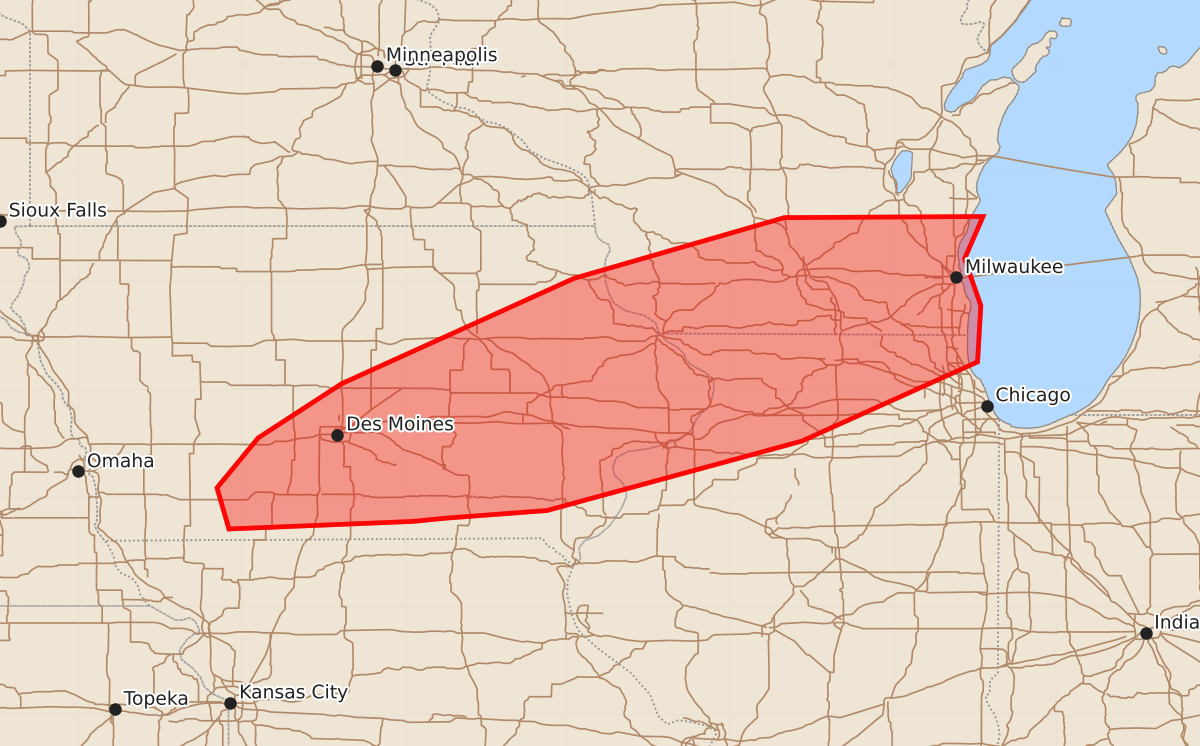
Summary
Severe storms capable of producing large hail, damaging winds, and tornadoes are expected across south-central and eastern Iowa, northern Illinois, and southern Wisconsin this afternoon and evening. The potential for severe weather is increasing as storm development intensifies throughout the area.
Product Text
000 ACUS11 KWNS 011934 SWOMCD SPC MCD 011934 ILZ000-WIZ000-IAZ000-012130- Mesoscale Discussion 1421 NWS Storm Prediction Center Norman OK 0234 PM CDT Wed Jul 01 2026 Areas affected...south-central ad eastern Iowa...northern Illinois...and southern Wisconsin. Concerning...Severe potential...Watch likely Valid 011934Z - 012130Z Probability of Watch Issuance...80 percent SUMMARY...The severe storm threat is expected to increase this afternoon and into the evening. DISCUSSION...A cluster of cumulus has had several initiation attempts with intermittent lightning across northeast Iowa. These initial attempts are likely struggling with the remaining mixed-layer inhibition observed by the 18Z DVN RAOB. Thus far, no storms have become rooted, but given the expansive nature of the cumulus cluster and repeated attempts in this region as well as additional boundary layer heating, expect eventual storm development from this activity. In addition, storms are likely across central and south-central Iowa this evening within the same maximum instability axis as ascent increases across this area. 50+ knots of mid-level flow (per DMX VWP) will support supercell storm mode and a threat for large hail and severe winds. As the low-level jet intensifies this evening, low-level shear will increase. Shear will be mostly unidirectional, but the strong speed shear, and any additional low-level vorticity along the boundary from earlier convection, could lead to some tornado threat this evening. A watch will likely be needed at some point this afternoon/evening. However, the timing remains somewhat uncertain. If the storm attempts across northeast Iowa become rooted, the watch may be issued soon, but if they continue to struggle, it may be later this afternoon before one is needed. ..Bentley/Guyer.. 07/01/2026 ...Please see www.spc.noaa.gov for graphic product... ATTN...WFO...LOT...MKX...DVN...ARX...DMX... LAT...LON 40789292 40719462 41099473 41559435 42059358 43029144 43588950 43598767 43208784 42778769 42258772 41528934 40889169 40819262 40789292 MOST PROBABLE PEAK TORNADO INTENSITY...85-110 MPH MOST PROBABLE PEAK WIND GUST...65-80 MPH MOST PROBABLE PEAK HAIL SIZE...1.50-2.50 IN