Mesoscale Discussion 1087
Issued: · Valid: –
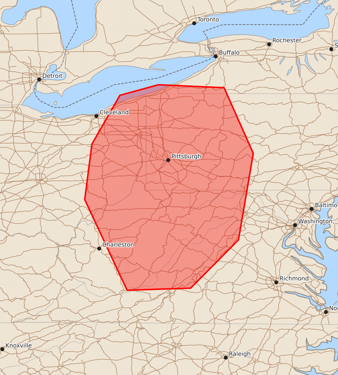
Summary
Scattered thunderstorms capable of producing severe wind gusts and possible hail are expected across western Pennsylvania, eastern Ohio, western Maryland, north-central Virginia, and much of West Virginia through early afternoon. Severe wind gusts could reach 55-70 mph with possible hail up to 1.25 inches.
Product Text
000 ACUS11 KWNS 111627 SWOMCD SPC MCD 111627 PAZ000-MDZ000-WVZ000-VAZ000-NYZ000-OHZ000-111830- Mesoscale Discussion 1087 NWS Storm Prediction Center Norman OK 1127 AM CDT Thu Jun 11 2026 Areas affected...western Pennsylvania...eastern Ohio...western Maryland...north-central Virginia...and much of West Virginia Concerning...Severe potential...Watch possible Valid 111627Z - 111830Z Probability of Watch Issuance...60 percent SUMMARY...Increasing thunderstorm coverage is anticipated across the region through early afternoon. The main risk will be severe wind gusts, and perhaps some hail. A severe thunderstorm watch may be warranted to cover these threats. DISCUSSION...Amidst a relatively zonal (if not slightly ridged) upper-air pattern, a subtle impulse is noted in water vapor imagery over western Lake Erie and central OH as of 1600z. Associated mesoscale ascent is contributing to increasing mid-level cloudiness in the area. Closer to the surface, diurnal heating and warm, moist advection with southwesterly surface flow is driving temperatures and dewpoints into the low-/mid- 80s and 70s F, respectively. The 12z PIT (Pittsburgh, PA) sounding showed steeper lapse rates around 1-3 km AGL (up to around 7 C/km) that decrease with height, and bulk shear around 20-25 kts. Over the next couple of hours, this modest westerly shear should persist as the mid-level impulse moves through. Associated forcing and diurnal destabilization should yield scattered thunderstorm development through the early afternoon. Relatively large CAPE values (around 2000+ J/kg) will support some downbursts/severe wind gusts with any stronger cores or merging outflows. The moist environment and weaker-shear regime should temper the hail threat, but some hail cannot be ruled out. ..Flournoy/Gleason.. 06/11/2026 ...Please see www.spc.noaa.gov for graphic product... ATTN...WFO...BUF...CTP...LWX...RNK...PBZ...RLX...CLE... LAT...LON 37368097 39508197 40818180 41968114 42218023 42147868 40597799 38557834 37417947 37368097 MOST PROBABLE PEAK WIND GUST...55-70 MPH MOST PROBABLE PEAK HAIL SIZE...UP TO 1.25 IN