Mesoscale Discussion 1764
Issued: · Valid: –
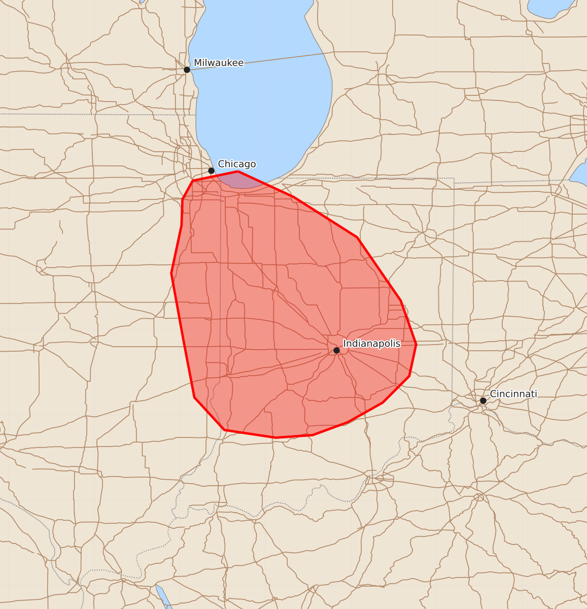
Summary
Damaging wind gusts up to 80 mph, large hail, and a possible tornado may impact far eastern Illinois and northern or central Indiana through the early evening. An intense bow echo is developing in these areas, bringing the potential for severe weather.
Product Text
000 ACUS11 KWNS 271809 SWOMCD SPC MCD 271808 INZ000-ILZ000-271945- Mesoscale Discussion 1764 NWS Storm Prediction Center Norman OK 0108 PM CDT Mon Jul 27 2026 Areas affected...portions of far eastern IL into IN Concerning...Severe potential...Watch likely Valid 271808Z - 271945Z Probability of Watch Issuance...95 percent SUMMARY...An intense bow echo is developing across northeast IL south of Chicago. Potential is increasing for a swath of severe/damaging gusts to develop southeast across parts of far eastern IL into northern/central IN through early evening. A new watch is likely downstream from WW 520. DISCUSSION...A supercell over northeast IL is transitioning toward an intense bow. This is occurring within a corridor of strong/extreme instability (3000-4000 J/kg MLCAPE) and 45+ kt effective shear magnitudes. The downstream airmass into central IN will support maintenance of this developing bow as convection develops southeast at around 40-45 kt. KLOT radar indicates 80 kt winds just a few hundred feet above ground level. Given the favorable thermodynamic and kinematic environment downstream, a swath of damaging winds to 80 mph will be possible across western portions of WW 519 over the next hour. Convection is expected to continue into central IN this afternoon into early evening. In addition to intense/damaging wind gusts, isolated large hail and a tornado or two also are possible. A downstream watch will likely be needed soon. ..Leitman/Hart.. 07/27/2026 ...Please see www.spc.noaa.gov for graphic product... ATTN...WFO...ILN...IWX...IND...LOT...ILX... LAT...LON 41848732 41548667 41078593 40338542 39828524 39458532 39148563 38918604 38768645 38738688 38828748 39208783 39888796 40658810 41218798 41518797 41738785 41848732 MOST PROBABLE PEAK TORNADO INTENSITY...85-110 MPH MOST PROBABLE PEAK WIND GUST...65-80 MPH MOST PROBABLE PEAK HAIL SIZE...1.00-1.75 IN