Day 3 Convective Outlook
Issued: · Valid: –
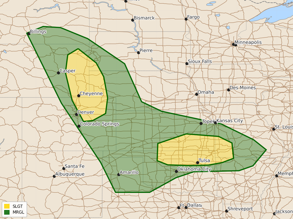
Summary
Scattered strong to severe thunderstorms are expected on Thursday across portions of the central and northern High Plains, as well as northern Oklahoma, southern Kansas, and the Ozarks. These storms may produce very large hail, damaging winds, and occasional tornadoes.
Product Text
000 ACUS03 KWNS 231932 SWODY3 SPC AC 231931 Day 3 Convective Outlook NWS Storm Prediction Center Norman OK 0231 PM CDT Tue Jun 23 2026 Valid 251200Z - 261200Z ...THERE IS A SLIGHT RISK OF SEVERE THUNDERSTORMS PORTIONS OF THE CENTRAL/NORTHERN HIGH PLAINS AND NORTHERN OKLAHOMA/SOUTHERN KANSAS INTO THE OZARKS... ...SUMMARY... Scattered strong to severe storms are possible across portions of the central/northern High Plains with a threat for large to very large hail and severe wind, and perhaps a tornado or two for portions of northern Oklahoma and southern Kansas into the Ozarks on Thursday. ...Synopsis... Embedded waves within a predominately zonal flow pattern and broad westerly flow aloft will extend across the central Rockies into the central/southern Plains on D3/Thursday. At the surface, a low will deepen and shift eastward across western Texas into eastern Oklahoma with attendant frontal boundary extending eastward across northern Oklahoma into the Missouri and Ohio Valley. ...Northern Oklahoma/southern Kansas into the Ozarks... Thunderstorms are likely to be ongoing at the start of the period across portions of southern Kansas into northern Oklahoma as a shortwave trough rotates through the pattern. Afternoon thunderstorm development will focus along the residual outflow/frontal boundary. Guidance suggests that though residual cloud cover may remain behind the morning convection, strong heating/destabilization should occur near the two boundaries into the afternoon. Strong deep layer shear around 40-50 kts should support supercell modes with potential for large to very large hail and damaging wind. With the deepening of the surface low, a southwesterly low-level jet will increase to around 40-50 kts into the afternoon/evening, which will enlarge low-level hodographs and lead to increasing tornado potential. There remains some uncertainty in the exact axis and strength of the low-level jet at this time. ...Central/Northern High Plains... Scattered thunderstorms are expected to develop with the combination of easterly upslope flow and upper-level forcing for ascent across portions of eastern Wyoming/Colorado. Moderate instability and strong deep layer shear will support supercells capable of large to very large hail and damaging wind. Storms will eventually cluster and move eastward, with potential for a few instances of damaging wind into western NE/KS. ..Thornton.. 06/23/2026 $$