Mesoscale Discussion 2304
Issued: · Valid: –
Summary
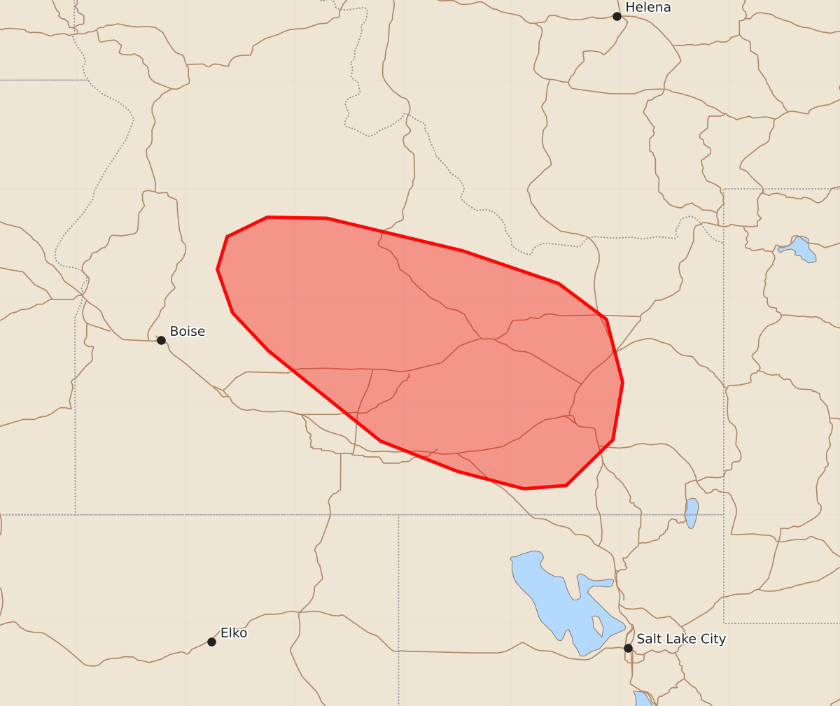
Severe thunderstorms capable of producing large hail and strong wind gusts are expected to develop across parts of southern and central Idaho through the remainder of this afternoon.
Product Text
000 ACUS11 KWNS 171947 SWOMCD SPC MCD 171946 IDZ000-172215- Mesoscale Discussion 2304 NWS Storm Prediction Center Norman OK 0246 PM CDT Thu Sep 17 2026 Areas affected...Parts of southern and central Idaho Concerning...Severe potential...Watch unlikely Valid 171946Z - 172215Z Probability of Watch Issuance...20 percent SUMMARY...The risk of a few severe storms capable of producing large hail and severe wind gusts will increase through the remainder of the afternoon. A watch is not currently expected, though trends are being monitored. DISCUSSION...Thunderstorms are gradually increasing in coverage across parts of southern and central ID. These storms are being aided by increasing large-scale forcing for ascent preceding a closed midlevel low over northern CA and localized terrain circulations. These storms will continue developing and spreading northward across southern into central ID this afternoon, given deep southerly steering flow. The 18Z BOI sounding sampled steep deep-layer lapse rates and an elongating/mostly straight hodograph (around 30-40 kt of cloud-layer shear per VWP and mesoanalysis data). Initially, cellular storms will pose a risk of large hail and locally severe wind gusts. With time, storms may organize into small clusters and pose an increasing risk of severe wind gusts. Currently, the risk appears too localized for a watch, though convective trends are being monitored. ..Weinman/Hart.. 09/17/2026 ...Please see www.spc.noaa.gov for graphic product... ATTN...WFO...PIH...MSO...BOI... LAT...LON 42241289 42401350 42681421 43511524 43861557 44261571 44561562 44741525 44731470 44431345 44131257 43801213 43221198 42691207 42271250 42241289 MOST PROBABLE PEAK WIND GUST...55-70 MPH MOST PROBABLE PEAK HAIL SIZE...1.00-1.75 IN