Mesoscale Discussion 1890
Issued: · Valid: –
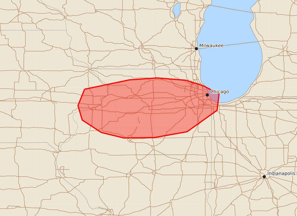
Summary
Severe thunderstorms capable of producing tornadoes, damaging winds, and large hail will affect northern Illinois overnight. The threat includes potential for brief tornadoes and wind gusts up to 70 mph through early Monday morning.
Product Text
000 ACUS11 KWNS 100353 SWOMCD SPC MCD 100353 INZ000-ILZ000-IAZ000-100600- Mesoscale Discussion 1890 NWS Storm Prediction Center Norman OK 1053 PM CDT Sun Aug 09 2026 Areas affected...northern Illinois Concerning...Severe Thunderstorm Watch 550... Valid 100353Z - 100600Z The severe weather threat for Severe Thunderstorm Watch 550 continues. SUMMARY...Severe potential continues within WW550. DISCUSSION...Supercells and supercell hybrid clusters continue across portions of northern Illinois. As the low-level jet has strengthened, a few low topped supercells have shown weak rotation. One supercell in Lee County near the warm front/outflow boundary across northern Illinois approached 60 kft with more pronounced and long lived rotation and reports of a tornado. VAD profiles from KLOT are sampling 0-3 km SRH around 350-400 m2/s2, with weakening flow above 3 km. Given the favorable low-level shear, transient weak rotation will likely continue with low topped cells south of the boundary. Any storm that can anchor to the boundary may have potential for a tornado in the short term. Mode is becoming more clustered through time, with increasing damaging wind potential later into the overnight. ..Thornton.. 08/10/2026 ...Please see www.spc.noaa.gov for graphic product... ATTN...WFO...LOT...ILX...DVN... LAT...LON 41999078 42238963 42288892 42228818 42088774 41878733 41458738 40908815 40758899 40748977 40889035 41209084 41579095 41999078 MOST PROBABLE PEAK TORNADO INTENSITY...85-110 MPH MOST PROBABLE PEAK WIND GUST...55-70 MPH MOST PROBABLE PEAK HAIL SIZE...UP TO 1.25 IN