Mesoscale Discussion 2296
Issued: · Valid: –
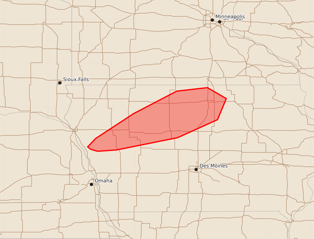
Summary
Scattered storms across western and northern Iowa may produce occasional marginally severe hail through the evening.
Product Text
000 ACUS11 KWNS 142333 SWOMCD SPC MCD 142332 IAZ000-150030- Mesoscale Discussion 2296 NWS Storm Prediction Center Norman OK 0632 PM CDT Mon Sep 14 2026 Areas affected...portions of western into northern Iowa Concerning...Severe potential...Watch unlikely Valid 142332Z - 150030Z Probability of Watch Issuance...5 percent SUMMARY...An instance or two of marginally severe hail may accompany one of the stronger storms. The severe threat should remain sparse, so a Severe Thunderstorm Watch issuance is not expected. DISCUSSION...Thunderstorms are increasing in coverage and intensity along a confluence zone, where maximized 925 hPa frontogenesis and 850 hPa WAA are taking place. These storms are developing atop a stable boundary layer, with 1000+ J/kg MUCAPE constrained above 850 hPa. As such, the ongoing storms are likely elevated in nature, and are benefiting from the strong tropospheric flow and 50 kts of effective bulk shear. A couple of marginally severe hailstones may occur with the stronger, sustained updrafts. However, any severe threat that materializes will likely be limited, so a Severe Thunderstorm Watch issuance is not anticipated. ..Squitieri/Smith.. 09/14/2026 ...Please see www.spc.noaa.gov for graphic product... ATTN...WFO...ARX...DMX...FSD...OAX... LAT...LON 42029543 41999586 42019594 42049603 42099609 42289591 42859504 43369406 43449336 43199293 42719313 42309404 42029543 MOST PROBABLE PEAK HAIL SIZE...UP TO 1.25 IN