Day 3 Convective Outlook
Issued: · Valid: –
Summary
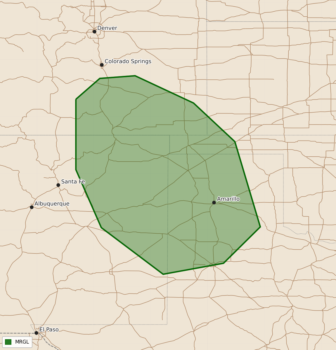
Scattered thunderstorms with marginal severe potential, including isolated damaging winds, are expected across the southern Rockies and Texas Panhandle during the afternoon and evening. Other scattered thunderstorms are possible across the northern Plains, Upper Midwest, and from the Gulf Coast to the Carolinas.
Product Text
000 ACUS03 KWNS 131942 SWODY3 SPC AC 131941 Day 3 Convective Outlook CORR 1 NWS Storm Prediction Center Norman OK 0241 PM CDT Sat Jun 13 2026 Valid 151200Z - 161200Z ...THERE IS A MARGINAL RISK OF SEVERE THUNDERSTORMS SOUTHERN ROCKIES INTO THE TEXAS PANHANDLE... CORRECTED FOR CAPITALIZATION OF PANHANDLE ...SUMMARY... Scattered thunderstorms over the southern Rockies may result in some severe potential as they move southeast during the afternoon and evening. Elsewhere, scattered thunderstorms are possible from the Gulf Coast states to the Carolinas, and across the northern Plains/Upper Midwest. ... Synopsis ... Broad mid-level troughing will persist across the eastern half of the US on Monday, downstream of a broad mid-level ridge across the eastern Pacific. A short-wave trough will dive southeast into the north-central US, embedded within the larger-scale northwest flow. At the surface, a remnant front will be draped across the northern Gulf Coast states, stretching from the southern Rockies east to the Atlantic. Farther north, a second cold front associated with the aforementioned north-central short-wave trough will push southeast into the central Plains and Upper Midwest. ... Southern Rockies into the Texas Panhandle ... Weak low-level upslope beneath northwesterly mid-level flow will support isolated to scattered thunderstorms developing across the higher terrain of the southern Rockies. CAPE around 1000-1500 J/kg and effective-layer shear around 30 knots will support some potential for thunderstorms organizing into a southeast-moving MCS capable of producing isolated damaging winds. ... Northern Gulf Coast States ... Rich boundary layer moisture will be present south of the sagging/stationary frontal boundary. Diurnal heating of this airmass should support thunderstorm development. This area will be well south of the better mid-level flow thus organized severe potential should remain fairly limited. That said, high precipitable water values and the number of storms across the region may support an isolated damaging wind gust. Overall coverage looks to remain less than 5%. ... Northern/Central Plains ... Although low-level moisture will be quite scant across the area, strong mid-upper-level forcing associated with the vorticity maximum moving across the area along with steepening lapse rates may support isolated high-based thunderstorm development. Gusty winds would be possible with any intense updraft, although this should remain fairly isolated and at this time does not warrant unconditional severe probabilities. ..Marsh.. 06/13/2026 $$