Day 3 Convective Outlook
Issued: · Valid: –
Summary
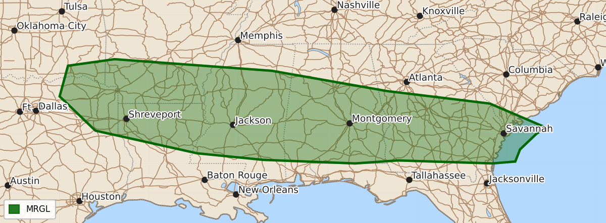
Isolated strong thunderstorms capable of producing damaging wind gusts may occur across the ArkLaTex and into the Southeast on Friday afternoon.
Product Text
000 ACUS03 KWNS 171931 SWODY3 SPC AC 171930 Day 3 Convective Outlook NWS Storm Prediction Center Norman OK 0230 PM CDT Wed Jun 17 2026 Valid 191200Z - 201200Z ...THERE IS A MARGINAL RISK OF SEVERE THUNDERSTORMS FROM THE ARKLATEX INTO THE SOUTHEAST... ...SUMMARY... Isolated strong thunderstorms may produce damaging wind gusts across the ArkLaTex into portions of the Gulf Coast states/Southeast on Friday. ...ArkLaTex into the Southeast... The stalled cold front will provide a focus for renewed convective development during the afternoon. A potential MCV in North Texas may drift eastward and promote afternoon convection. Otherwise, strong heating of a low/mid 70s F dewpoint airmass south of the boundary will promote moderate to strong buoyancy (2500-3500 J/kg MLCAPE). Deep-layer flow will be weak, but strong water-loaded downdrafts will be capable of damaging wind gusts. ...Upper Mississippi Valley... A compact, strong shortwave trough will move through the northern Plains into the Upper Mississippi Valley during the afternoon. Given the short wavelength between the upper trough in the Northeast and this compact system, moisture return will be somewhat limited (dewpoints in the mid to perhaps upper 50s F). Temperatures aloft, however, will be quite cold (-18 to -20 C at 500 mb). Widely scattered convection appears probable ahead of the shortwave trough along and near a weak surface trough. Storms appear they will be relatively low topped. Given the limited moisture/buoyancy, small hail is possible, but potential for large hail is too low for probabilities. ..Wendt.. 06/17/2026 $$