Mesoscale Discussion 1398
Issued: · Valid: –
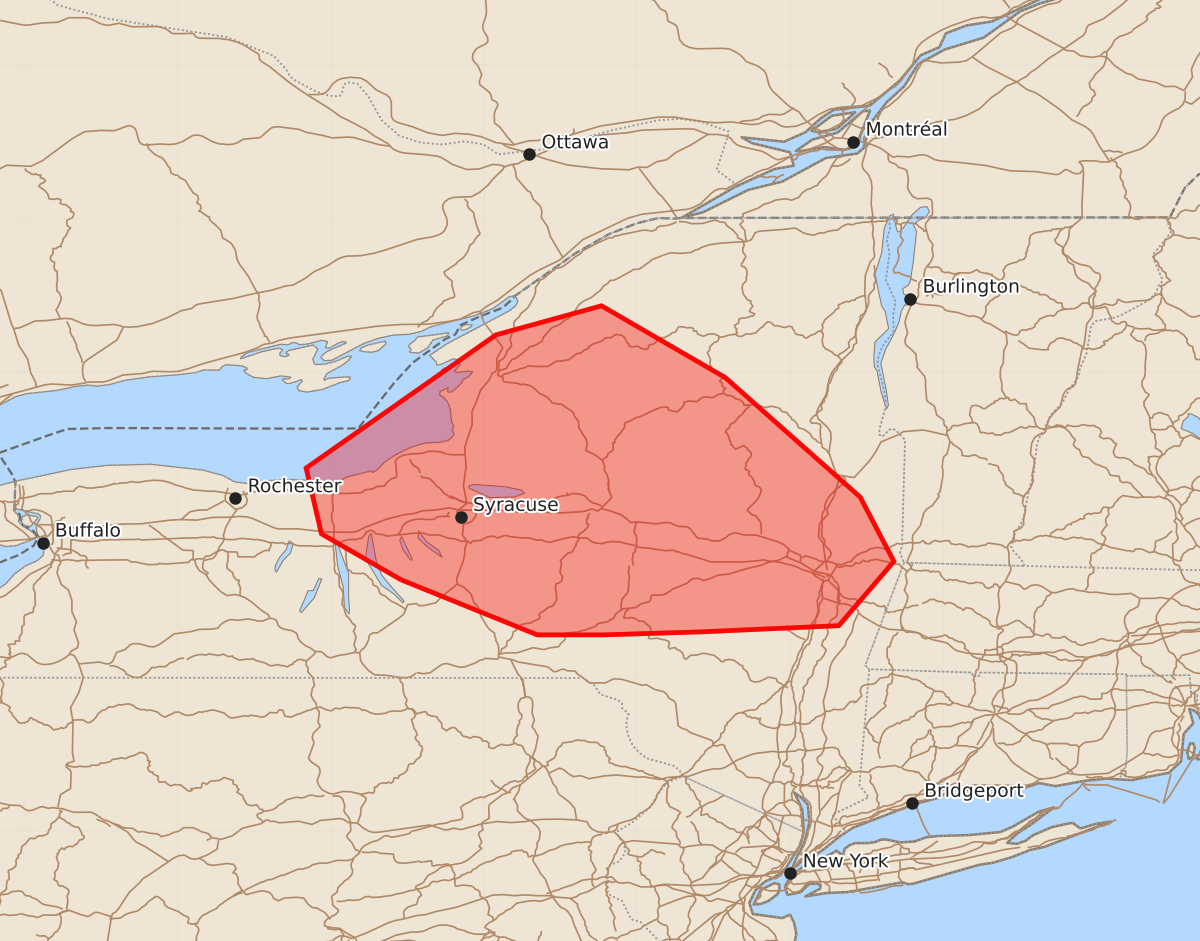
Summary
Severe thunderstorms capable of producing damaging wind gusts up to 70 mph and large hail are expected across central New York through the afternoon of June 30, 2026.
Product Text
000 ACUS11 KWNS 301849 SWOMCD SPC MCD 301848 NYZ000-302045- Mesoscale Discussion 1398 NWS Storm Prediction Center Norman OK 0148 PM CDT Tue Jun 30 2026 Areas affected...Central New York Concerning...Severe Thunderstorm Watch 423... Valid 301848Z - 302045Z The severe weather threat for Severe Thunderstorm Watch 423 continues. SUMMARY...The threat for mainly damaging winds with gusts up to 60-70 mph will continue across the watch area. DISCUSSION...Recent trends in IR and radar data indicate a temporary weakening of a long-lived bow echo present across portions of Herkimer, Lewis, and Oneida Counties as of 1840z. However, close inspection of the radar data suggests that the cold pool and low-level shear remain in balance, and it is quite possible the system will re-intensify over the next hour our two as the western flank of the system encounters an increasingly unstable air mass. The KTYX VWP sampled the rear-inflow jet of the bow echo with 50 kt winds observed as low as 1 km AGL. Steepening low-level lapse rates within the inflow region of the bow echo may allow for the more efficient downward transfer of the stronger winds aloft as the system begins to interact with the more unstable environment. More recent, discrete storm development has occurred to the southwest of the bow echo in Wayne County, NY within the axis of stronger instability. Sufficient vertical shear exists in that area to support some storm organization, including supercell structures with an associated risk for large hail and damaging wind gusts. ..Mead.. 06/30/2026 ...Please see www.spc.noaa.gov for graphic product... ATTN...WFO...BTV...ALY...BGM...BUF... LAT...LON 42647654 42947706 43377716 44247592 44437523 43967442 43187354 42767332 42347368 42307457 42287522 42287565 42647654 MOST PROBABLE PEAK TORNADO INTENSITY...UP TO 90 MPH MOST PROBABLE PEAK WIND GUST...55-70 MPH MOST PROBABLE PEAK HAIL SIZE...1.00-1.75 IN