Mesoscale Discussion 1159
Issued: · Valid: –
Summary
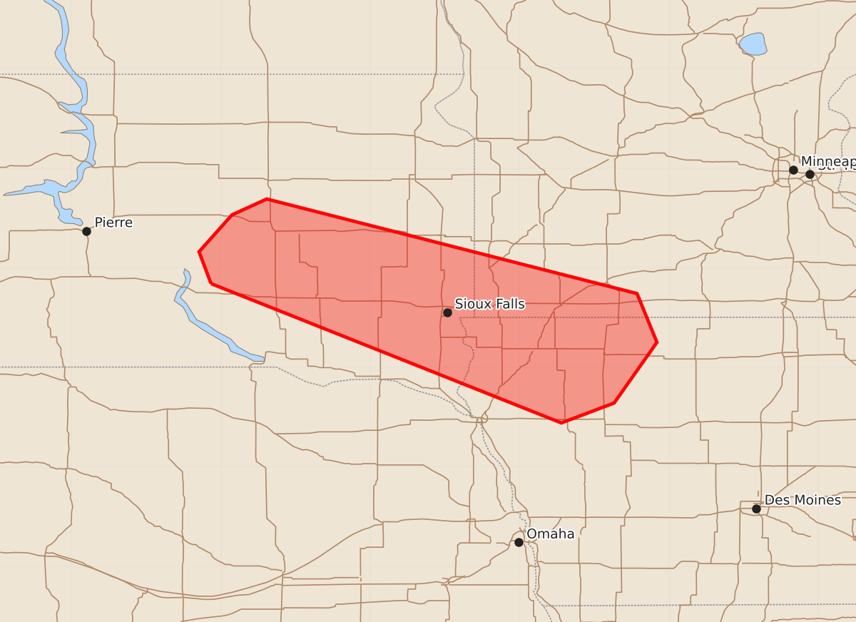
Isolated hail and severe wind gusts are possible for southeast South Dakota, southwest Minnesota, and northwest Iowa between 12 a.m. and 3 a.m. CDT. The severity is expected to increase during this period, with potential wind gusts up to 70 mph and hail up to 1.25 inches.
Product Text
000 ACUS11 KWNS 170429 SWOMCD SPC MCD 170428 MNZ000-IAZ000-SDZ000-170630- Mesoscale Discussion 1159 NWS Storm Prediction Center Norman OK 1128 PM CDT Tue Jun 16 2026 Areas affected...east-central and southeast SD...far southwest MN...northwest IA Concerning...Severe potential...Watch unlikely Valid 170428Z - 170630Z Probability of Watch Issuance...20 percent SUMMARY...Isolated hail/wind potential increasing with southeast extent and during the 05-08z (12am-3am CDT) period. DISCUSSION...A lobe of upper-level forcing for ascent associated with an approaching upper jet streak will continue to rapidly move east-southeast from the MT/Dakotas border and across the Dakotas tonight. As this occurs, strengthening low-level warm-air advection to the north (immediate cool side) of a west-northwest to east-southeast oriented frontal zone (analyzed from western SD into southeast SD) will act to destabilize the airmass over parts of the mid MO Valley tonight. Forecast soundings over central SD (valid currently at 04z) show scant buoyancy amidst strong deep-layer shear and elongated hodographs. RAP forecast soundings near Sioux City, IA over the next few hours show moisture increasing in the 900-800 mb layer as the terminus of a LLJ focuses over the region. As a result, elevated parcels will attain much greater buoyancy (e.g., less than 100 J/kg to 2500 J/kg MUCAPE) through 08z. It is plausible as both the elevated instability and forcing for ascent develop and overspread parts of southeast SD into adjacent portions of MN/IA, that intensification of ongoing storms moving southeast will occur or additional storms will develop and strengthen. Although some uncertainty remains regarding the evolution of storm activity, at least an isolated risk for large hail and severe gusts may develop tonight and become increasingly possible with time (i.e., 05 to 08 UTC). ..Smith/Gleason.. 06/17/2026 ...Please see www.spc.noaa.gov for graphic product... ATTN...WFO...MPX...DMX...FSD...ABR... LAT...LON 43849910 44169922 44539889 44699854 43749482 43259462 42649505 42449558 43849910 MOST PROBABLE PEAK WIND GUST...55-70 MPH MOST PROBABLE PEAK HAIL SIZE...UP TO 1.25 IN