Mesoscale Discussion 1358
Issued: · Valid: –
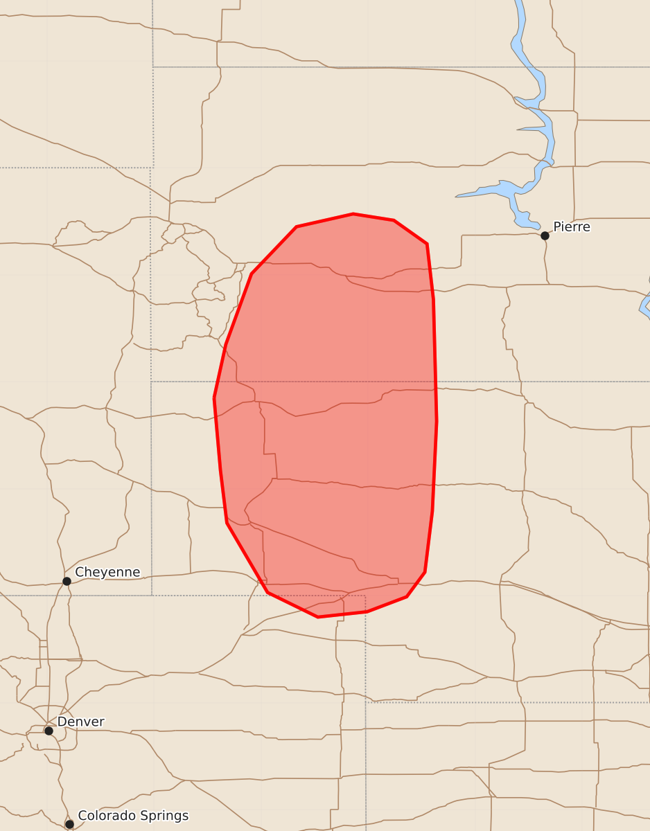
Summary
Isolated to scattered thunderstorms across southwestern South Dakota and the Nebraska Panhandle may produce large hail, damaging wind gusts, and a potential risk for tornadoes through late evening. The most severe threats include very large hail up to 3.5 inches and wind gusts between 65 and 80 mph.
Product Text
000 ACUS11 KWNS 280010 SWOMCD SPC MCD 280010 NEZ000-SDZ000-COZ000-280145- Mesoscale Discussion 1358 NWS Storm Prediction Center Norman OK 0710 PM CDT Sat Jun 27 2026 Areas affected...portions of southwestern South Dakota into the Nebraska Panhandle Concerning...Tornado and Severe Thunderstorm Watches 406...407... Valid 280010Z - 280145Z The severe weather threat for Tornado and Severe Thunderstorm Watches 406, 407 continues. SUMMARY...Isolated to widely scattered convection continues to pose a risk for primarily large hail and damaging wind gusts. DISCUSSION...Isolated to widely scattered supercells have developed across far southwestern South Dakota and northwestern Nebraska as of 2350 UTC to the west of a diffuse dryline. In the near-term, the primary risk associated with this convection will be large to very large hail (perhaps to 2.5+ inches in diameter) given strong effective shear, elongated hodographs, and ample buoyancy within the hail growth zone (as supported by SHIP values ranging form 1-3+ per latest objective analysis). Recent high-res guidance and regional radar imagery suggest that rapid upscale growth may occur with the ongoing convection across southwestern South Dakota, which would favor a transition towards damaging/severe wind gusts as the primary risk. Farther south, ongoing convection is likely to remain more isolated within the Nebraska Panhandle, with large to very large hail and damaging wind gusts being possible with supercells. Additional development farther south into southwestern Nebraska remains uncertain at this time. Some increase in tornado potential may occur with time and as convection progresses eastward given greater moisture to the east of the diffuse dryline and a strengthening nocturnal low-level jet that will yield increasingly clockwise-curved low-level hodographs. A more linear storm mode and greater convective inhibition/capping to the east of the dryline lend uncertainty to the magnitude of the tornado risk, however. The greatest risk for a tornado is likely to occur with any discrete supercell that can persist farther east into this evening. ..Chalmers.. 06/28/2026 ...Please see www.spc.noaa.gov for graphic product... ATTN...WFO...LBF...UNR...BOU...CYS... LAT...LON 42850344 43350333 44010309 44450267 44570214 44510176 44290145 43770139 42630136 41790140 41220147 40990164 40850201 40800247 41030294 41680332 42170338 42850344 MOST PROBABLE PEAK TORNADO INTENSITY...85-110 MPH MOST PROBABLE PEAK WIND GUST...65-80 MPH MOST PROBABLE PEAK HAIL SIZE...2.00-3.50 IN