Mesoscale Discussion 1456
Issued: · Valid: –
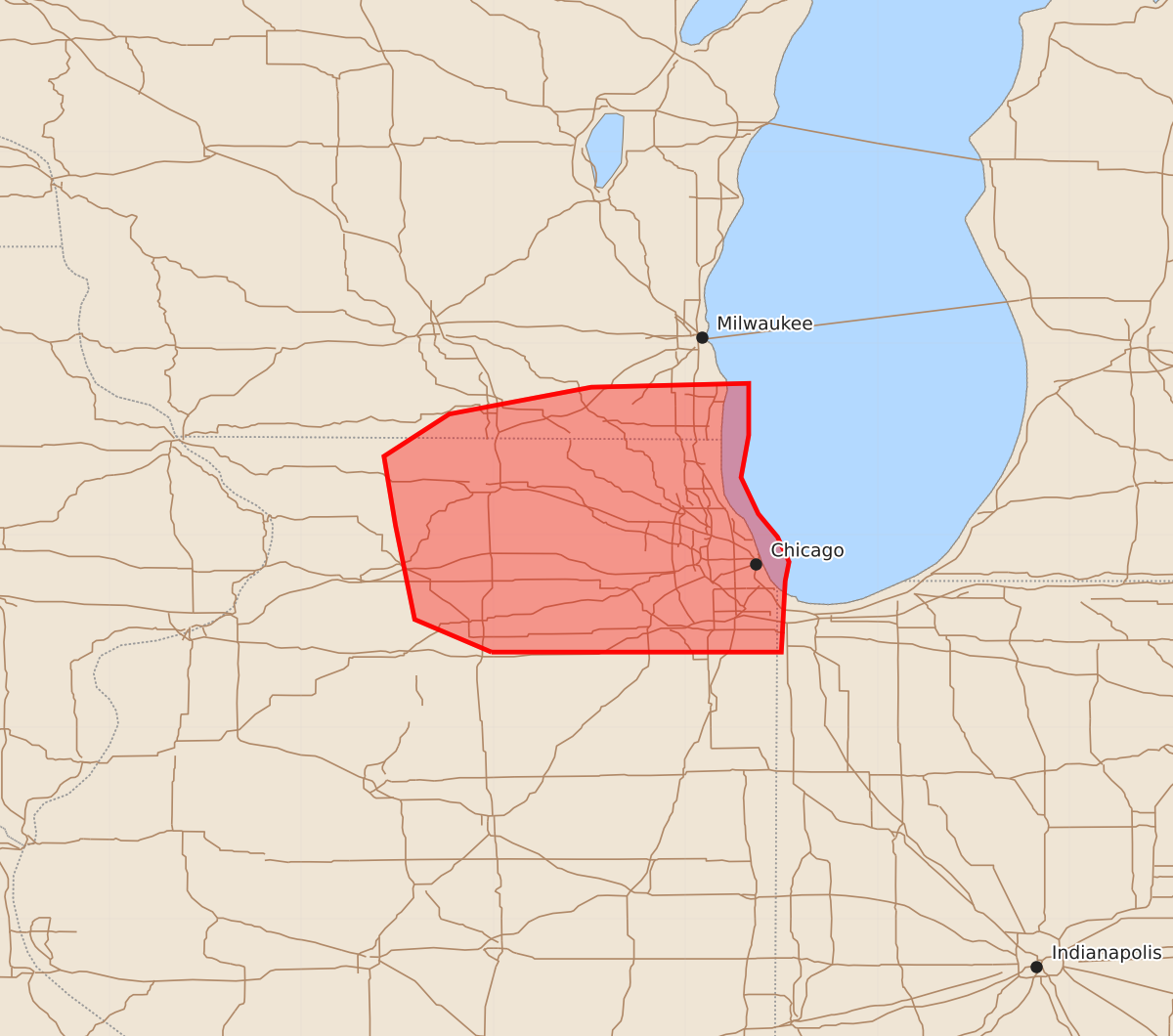
Summary
Developing thunderstorms across northeast Illinois may produce large hail and damaging winds through the late evening hours.
Product Text
000 ACUS11 KWNS 030041 SWOMCD SPC MCD 030040 INZ000-ILZ000-WIZ000-030245- Mesoscale Discussion 1456 NWS Storm Prediction Center Norman OK 0740 PM CDT Thu Jul 02 2026 Areas affected...Northeast Illinois Concerning...Severe potential...Watch possible Valid 030040Z - 030245Z Probability of Watch Issuance...40 percent SUMMARY...Thunderstorms developing across northeast Illinois may pose a risk of large hail and damaging winds through the late evening hours. Watch issuance is possible if T-storm coverage/intensity sufficiently increases. DISCUSSION...The early stages of thunderstorm development are noted along a subtle low-level confluence band across northeast IL and into extreme southeast WI. This confluence band remains just ahead of a more prominent outflow boundary quickly approaching from the west. The pre-outflow environment over the greater Chicago area was recently sampled by an ACARs sounding out of Midway, which depicted a largely uncapped and buoyant, but only modestly sheared, environment. However, an upstream 00 UTC RAOB from DVN (taken ahead of the outflow boundary) sampled stronger (40 knot) mid-level flow that is likely approaching the region. Based on these observations, there is reason to expect some degree of storm organization in the coming hours across northeast IL as the stronger mid-level flow spreads east. Emerging convection will likely trend towards clusters with time given the orientation of the zone of initiation with the mean flow, but a supercell or two appears possible - both ahead of and along/behind the primary outflow boundary - in the next few hours. Guidance continues to handle this regime poorly, and it's unclear if convection will intensify to severe limits before reaching the Lake Michigan shore. Nonetheless, trends will be monitored, and watch issuance is possible if the severe threat appreciably increases. ..Moore/Guyer.. 07/03/2026 ...Please see www.spc.noaa.gov for graphic product... ATTN...WFO...LOT...MKX...DVN... LAT...LON 41398901 41568941 42058951 42418957 42638923 42778849 42798767 42528767 42308771 42118762 41998752 41868746 41768748 41398750 41398901 MOST PROBABLE PEAK WIND GUST...55-70 MPH MOST PROBABLE PEAK HAIL SIZE...UP TO 1.25 IN