Mesoscale Discussion 1293
Issued: · Valid: –
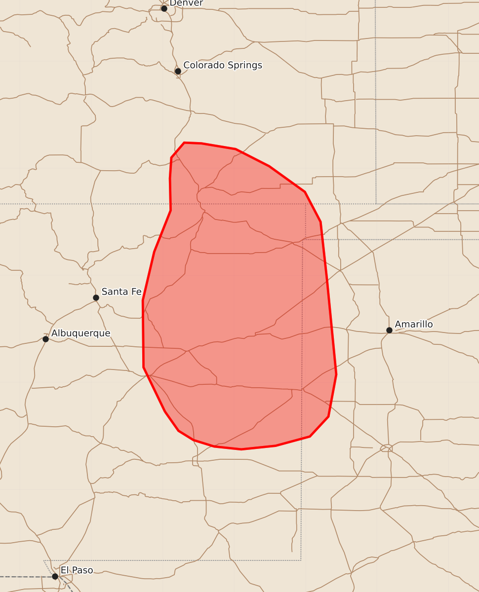
Summary
Severe thunderstorms capable of producing damaging winds and large hail are expected to move through eastern New Mexico, southern Colorado, and the Texas Panhandle during the late afternoon and early evening. These storms may reach significant severity with wind gusts up to 70 mph and hail as large as 1.75 inches.
Product Text
000 ACUS11 KWNS 241811 SWOMCD SPC MCD 241811 OKZ000-COZ000-TXZ000-NMZ000-242045- Mesoscale Discussion 1293 NWS Storm Prediction Center Norman OK 0111 PM CDT Wed Jun 24 2026 Areas affected...Eastern New Mexico into southern Colorado and the Texas Panhandle Concerning...Severe potential...Watch possible Valid 241811Z - 242045Z Probability of Watch Issuance...60 percent SUMMARY...Thunderstorms developing within the higher terrain of the southern Rockies will pose a severe wind/hail threat as they spread east through the late afternoon and early evening. Watch issuance will likely be needed later this afternoon. DISCUSSION...The effects of strong diurnal heating/boundary-layer mixing and orographic ascent are quickly becoming apparent in GOES imagery across much of New Mexico. Several regions of building cumulus are noted as temperatures warm into the low 90s and lingering inhibition quickly erodes. Building cumulus is also noted along the Sangre De Cristo and Sandia Manzano mountains where upslope flow is providing focused forcing for ascent a few deeper towers are noted in low-level water-vapor imagery, suggesting that initial attempts at deep convective initiation will likely occur within the next hour or so. Sustained convection developing along the terrain will spread east within given westerly flow regime aloft. Lingering inhibition at lower elevations may limit how quickly high-based convection can utilize near-surface parcels, but once MLCIN erodes and/or cold pools can become sufficiently deep, convection will be influenced by the regionally rich low-level moisture in place across eastern NM/CO (dewpoints in the upper 50s to 60s) that is supporting MLCAPE values upwards of 1500 J/kg. Concurrently, convection will begin to realize the 30-35 knots of deep-layer wind shear (sampled by the KFDX VWP), which should promote supercellular storm modes initially with an attendant threat for large hail and severe gusts. Watch issuance will likely be needed by late afternoon as convection begins to mature and spread east into the more buoyant air mass. ..Moore/Guyer.. 06/24/2026 ...Please see www.spc.noaa.gov for graphic product... ATTN...WFO...LUB...AMA...PUB...ABQ... LAT...LON 34090497 34710527 35650528 36330512 36910489 37360490 37650488 37860470 37850446 37770398 37530351 37170301 36750279 35940270 34610257 34020268 33740294 33610342 33560390 33600428 33690457 33820478 34090497 MOST PROBABLE PEAK WIND GUST...55-70 MPH MOST PROBABLE PEAK HAIL SIZE...1.00-1.75 IN