Watch 620 Outline
Issued:
Summary
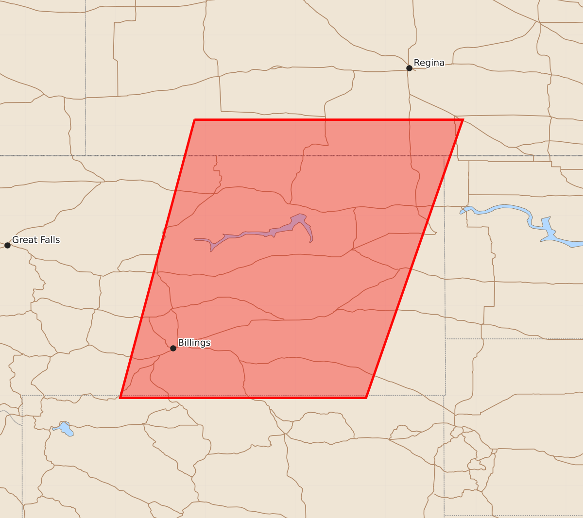
A severe thunderstorm watch is in effect for an area spanning approximately 100 miles east and west of a line from Glasgow to Billings, Montana, through 4:00 AM. Expected hazards include 1.5-inch hail and wind gusts up to 65 knots.
Product Text
000 WWUS30 KWNS 232145 SAW0 SPC AWW 232145 WW 620 SEVERE TSTM MT 232150Z - 240400Z AXIS..100 STATUTE MILES EAST AND WEST OF LINE.. 55NNE GGW/GLASGOW MT/ - 80SE BIL/BILLINGS MT/ ..AVIATION COORDS.. 85NM E/W /48NNE GGW - 16WNW SHR/ HAIL SURFACE AND ALOFT..1.5 INCHES. WIND GUSTS..65 KNOTS. MAX TOPS TO 450. MEAN STORM MOTION VECTOR 27030. LAT...LON 48930395 44960533 44960942 48930836 THIS IS AN APPROXIMATION TO THE WATCH AREA. FOR A COMPLETE DEPICTION OF THE WATCH SEE WOUS64 KWNS FOR WOU0.