Mesoscale Discussion 2027
Issued: · Valid: –
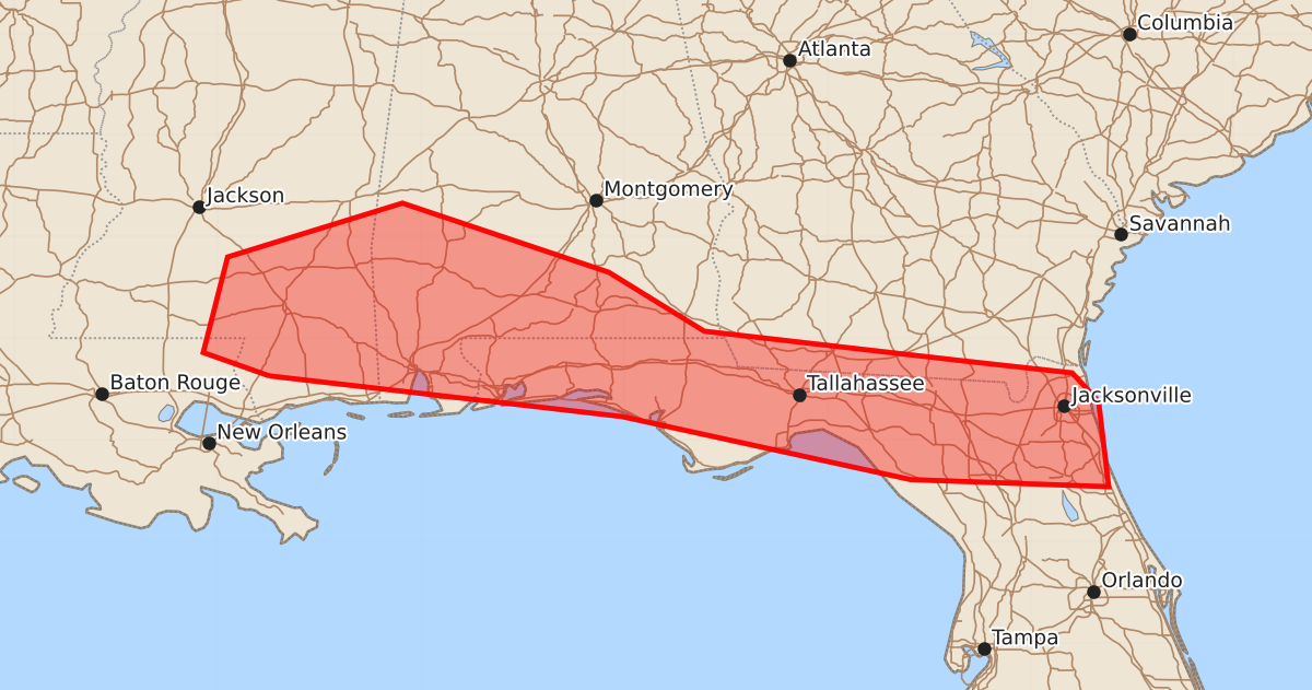
Summary
Locally damaging wind gusts up to 60 mph are possible across the central and eastern Gulf Coast into north Florida this afternoon.
Product Text
000 ACUS11 KWNS 182020 SWOMCD SPC MCD 182020 FLZ000-GAZ000-ALZ000-MSZ000-LAZ000-182215- Mesoscale Discussion 2027 NWS Storm Prediction Center Norman OK 0320 PM CDT Tue Aug 18 2026 Areas affected...Central/eastern Gulf Coast into North Florida Concerning...Severe potential...Watch unlikely Valid 182020Z - 182215Z Probability of Watch Issuance...5 percent SUMMARY...Locally damaging winds are possible this afternoon. A watch is not expected. DISCUSSION...Scattered convection has developed along the Gulf breeze front within a very moist (low 70s F dewpoints), high PWAT (2-2.5 in.) airmass. 12Z/18Z observed soundings from the region showed poor mid-level lapse rates. This, and very weak shear, will keep storms unorganized. However, water-loaded downdrafts may produce locally damaging winds with low-level lapse having steepened substantially this afternoon. ..Wendt/Guyer.. 08/18/2026 ...Please see www.spc.noaa.gov for graphic product... ATTN...WFO...JAX...TAE...BMX...MOB...JAN...LIX... LAT...LON 30638949 30869014 31808990 32338818 31658615 31078521 30788268 30668159 30388133 29548123 29618318 30238602 30638949 MOST PROBABLE PEAK WIND GUST...UP TO 60 MPH