Mesoscale Discussion 1229
Issued: · Valid: –
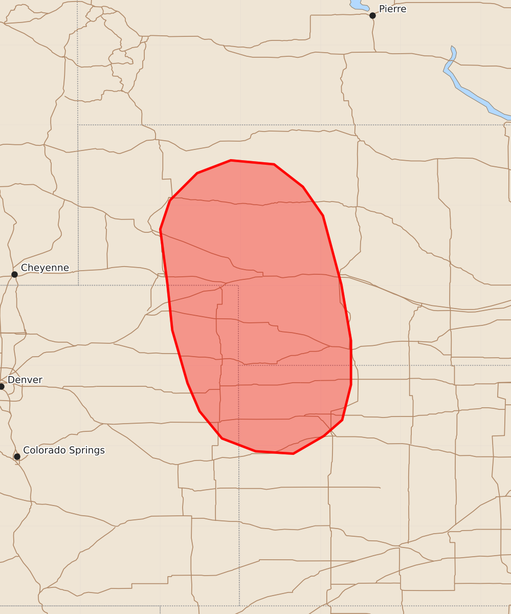
Summary
Severe thunderstorms capable of producing very large hail and strong winds may develop across western Nebraska, northeast Colorado, and northwest Kansas this afternoon. Thunderstorm initiation is expected within the next one to two hours, with watches likely to be issued as conditions mature.
Product Text
000 ACUS11 KWNS 211752 SWOMCD SPC MCD 211751 NEZ000-KSZ000-COZ000-211945- Mesoscale Discussion 1229 NWS Storm Prediction Center Norman OK 1251 PM CDT Sun Jun 21 2026 Areas affected...Western Nebraska...northeast Colorado...and northwest Kansas Concerning...Severe potential...Watch likely Valid 211751Z - 211945Z Probability of Watch Issuance...80 percent SUMMARY...Conditions are being monitored for thunderstorm initiation across the NE/CO/KS tri-state region, which may be within the next 1-2 hours. Watch issuance is likely at some point this afternoon. DISCUSSION...Latest GOES imagery and surface observations show the early stages of deepening cumulus in proximity to a diffuse surface low and along low-level trough axes/confluence zones. This comes as upper-level ascent associated with an upstream wave over WY continues to migrate southeast and as temperatures begin to warm into the upper 70s and low 80s. Recent RAP mesoanalyses continue to show some lingering inhibition across the effective warm sector (where dewpoints remain the 50s to low 60s), but forecast guidance suggests that this inhibition will be largely removed as temperatures continue to warm into the low to mid 80s. These solutions also depict initiation of deep convection by around 20 UTC; however, based on the latest GOES trends and current temperatures, initiation may occur slightly earlier across western NE and along the NE/CO border. Once initiation does occur, convection will mature within an environment favorable for splitting supercells capable of very large hail given mostly straight, elongated hodographs across the region and sufficient mixed-layer buoyancy (MLCAPE of around 1500-2000 J/kg). Consequently, watch issuance is expected in the coming hours as initiation becomes more probable. ..Moore/Hart.. 06/21/2026 ...Please see www.spc.noaa.gov for graphic product... ATTN...WFO...LBF...GLD...BOU...CYS... LAT...LON 42060288 42400254 42560212 42510158 42230122 41870097 41010074 40310062 39760062 39320073 39120096 38900134 38930181 39090223 39430251 39780266 40440285 41010291 41700300 42060288 MOST PROBABLE PEAK TORNADO INTENSITY...UP TO 90 MPH MOST PROBABLE PEAK WIND GUST...65-80 MPH MOST PROBABLE PEAK HAIL SIZE...1.50-2.50 IN