Mesoscale Discussion 1236
Issued: · Valid: –
Summary
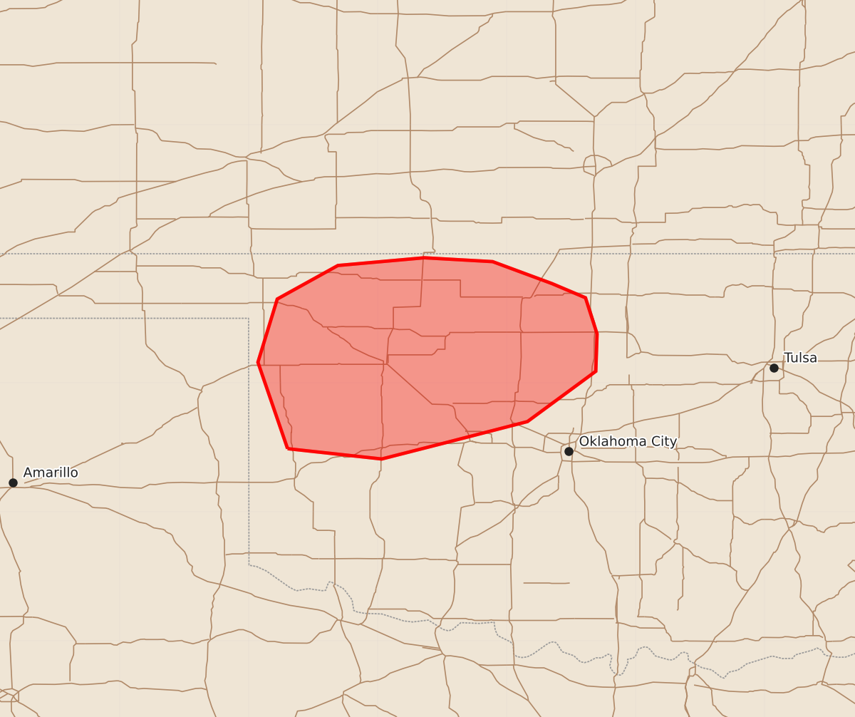
Severe thunderstorms capable of producing large hail, damaging winds, and possible tornadoes may develop across northwest Oklahoma this evening and continue into tonight.
Product Text
000 ACUS11 KWNS 212313 SWOMCD SPC MCD 212312 OKZ000-220115- Mesoscale Discussion 1236 NWS Storm Prediction Center Norman OK 0612 PM CDT Sun Jun 21 2026 Areas affected...northwest Oklahoma Concerning...Severe potential...Watch possible Valid 212312Z - 220115Z Probability of Watch Issuance...40 percent SUMMARY...Thunderstorms may develop across the area this evening. Should they develop, the overall environment will support large hail and damaging winds and a watch would become necessary. The area will be monitored closely for thunderstorm potential and subsequent need for a watch. DISCUSSION...A remnant outflow boundary is located across northern Oklahoma, stretching from near Woodward, OK, east toward Ponca City, OK. The cumulus field along this boundary has become increasingly agitated over the last hour, with clumping of the cumulus across Woodward County, OK, noted. Thunderstorm development is uncertain this afternoon, with the high-resolution numerical guidance oscillating back and forth between solutions with initiation and solutions without initiation. (The most recent runs of the HRRR -- 21 & 22 UTC -- do initiate this evening across northwest Oklahoma.) Should storms develop, the overall thermodynamic environment across the area is very unstable with MUCAPE values between 3000-4000 J/kg, with forecast soundings suggesting the maximum lapse rates in the 2-6 kilometer layer achieving 8 C/km. Kinematically, the environment is strongly sheared, with effective-layer shear around 40 knots. Given this environment, an evolution toward supercells would be possible with any thunderstorm. Relatively straight hodographs would suggest that splitting supercells would be possible, with large hail and damaging winds possible (RAP profiles suggest DCAPE ~1500 J/kg). Low-level flow is relatively weak across the area, so the overall tornado threat should be somewhat limited. However, with the potential for supercellular mode, strong instability, and a surface boundary, the tornado potential is non-negligible. Should confidence increase that initiation is underway or imminent, a watch may become necessary across portions of northwest Oklahoma. Regardless of whether thunderstorms initiate this afternoon/evening, a more appreciable threat for severe thunderstorms is likely to evolve later tonight with a southeast-advancing MCS moving into the region from Kansas. ..Marsh/Smith.. 06/21/2026 ...Please see www.spc.noaa.gov for graphic product... ATTN...WFO...OUN... LAT...LON 35499970 36169993 36659978 36919931 36979864 36949811 36779765 36669739 36389730 36099731 35709784 35549846 35419897 35499970 MOST PROBABLE PEAK TORNADO INTENSITY...UP TO 90 MPH MOST PROBABLE PEAK WIND GUST...65-80 MPH MOST PROBABLE PEAK HAIL SIZE...1.50-2.50 IN