Mesoscale Discussion 1154
Issued: · Valid: –
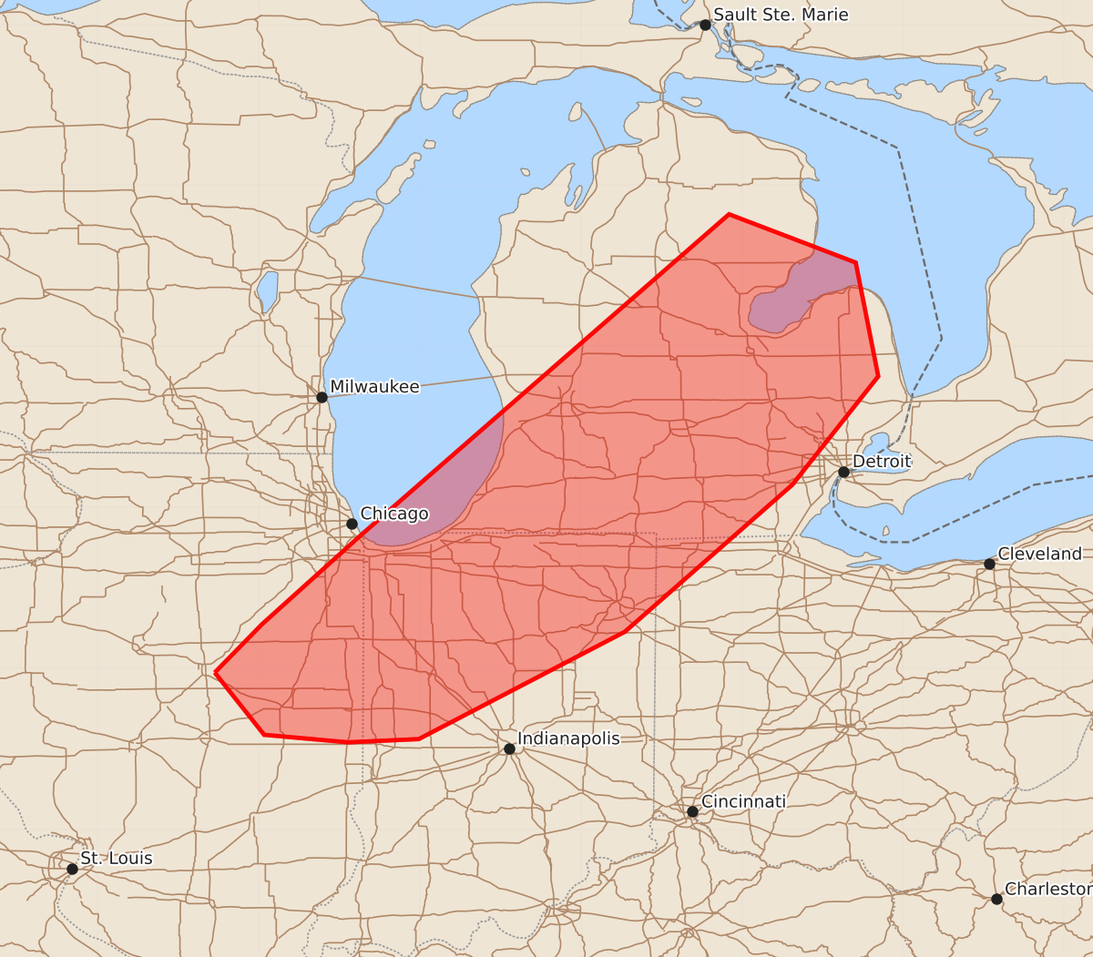
Summary
Increasing thunderstorm activity across eastern Illinois, northern Indiana, and lower Michigan this afternoon may produce damaging winds, large hail, and a couple of tornadoes. These severe weather threats are expected to persist through the late afternoon.
Product Text
000 ACUS11 KWNS 161722 SWOMCD SPC MCD 161722 MIZ000-OHZ000-INZ000-ILZ000-161915- Mesoscale Discussion 1154 NWS Storm Prediction Center Norman OK 1222 PM CDT Tue Jun 16 2026 Areas affected...eastern Illinois...northern Indiana...lower Michigan Concerning...Severe potential...Watch likely Valid 161722Z - 161915Z Probability of Watch Issuance...80 percent SUMMARY...Thunderstorm activity to increase through the afternoon with potential for damaging winds, large hail, and a couple of tornadoes. DISCUSSION...Thunderstorm activity is increasing across portions of lower Michigan ahead of a surface low/cold front located across Wisconsin. This activity will pose some risk for marginally severe hail in the near term. Additional development is expected back west near the cold front across Illinois by early afternoon. While thermo profiles ahead of the front remain meager, temperatures are steadily cooling aloft with the approach of the upper low. This will likely modify profiles quickly through the afternoon. Shear profiles support initial supercell modes along the front this afternoon across Illinois into northern Indiana and far southern Michigan. Given the steepening lapse rates and strong deep layer shear, large hail and damaging wind will be possible. Curved low-level hodographs will support some enhancement of SRH across northern Indiana into southern Michigan with potential for a tornado or two. Upscale growth is expected with time, with a shift in the main threat to become damaging wind with time. A watch will likely be needed for parts of the area to cover these potential threats in the next couple of hours. ..Thornton/Hart.. 06/16/2026 ...Please see www.spc.noaa.gov for graphic product... ATTN...WFO...DTX...APX...IWX...GRR...IND...LOT...ILX... LAT...LON 40468891 40918847 41738756 44738412 44288294 43228273 42218353 40848509 39848701 39818767 39888845 40468891 MOST PROBABLE PEAK TORNADO INTENSITY...85-110 MPH MOST PROBABLE PEAK WIND GUST...55-70 MPH MOST PROBABLE PEAK HAIL SIZE...1.00-1.75 IN