Mesoscale Discussion 1978
Issued: · Valid: –
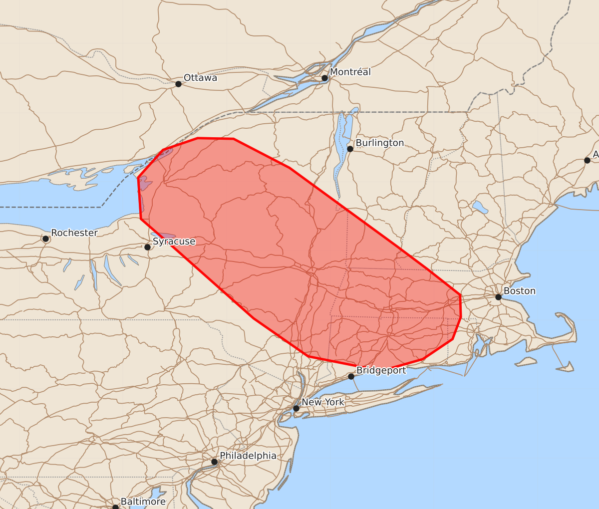
Summary
Isolated damaging wind gusts and possibly small hail may occur across portions of New York and southern New England this afternoon. These thunderstorms are expected to bring relatively low-to-moderate severity through the afternoon.
Product Text
000 ACUS11 KWNS 141936 SWOMCD SPC MCD 141935 RIZ000-MAZ000-CTZ000-NHZ000-VTZ000-NYZ000-142130- Mesoscale Discussion 1978 NWS Storm Prediction Center Norman OK 0235 PM CDT Fri Aug 14 2026 Areas affected...portions of northern/eastern New York into southern New England Concerning...Severe potential...Watch unlikely Valid 141935Z - 142130Z Probability of Watch Issuance...5 percent SUMMARY...Lop-topped thunderstorms may bring an isolated risk for damaging wind gusts (and perhaps an instance of marginally severe hail) to portions of New York and southern New England this afternoon. DISCUSSION...Regional radar imagery depicts a cluster of ongoing thunderstorms that have recently progressed from southern Ontario into Upstate New York immediately ahead of a mid-level shortwave trough evident in visible satellite imagery. Cold mid-level temperatures associated with this shortwave and steep low-level lapse rates have allowed for the development of weak buoyancy (on the order of a few hundred J/kg MLCAPE), which is sufficient for a few relatively low-topped thunderstorms. Strong northwesterly, mid-to-upper level flow (sampled by the TYX VWP) is supporting modest effective shear (25-35+ kts) and some updraft organization. While it remains unclear how long ongoing convection will be maintained owing to limited available buoyancy, forcing associated with the mid-level shortwave may allow for the persistence of ongoing convection southeastward toward southern New England and/or additional downstream development through the afternoon. Should this occur, isolated damaging wind gusts (and perhaps an instance of marginally severe hail in the near-term) are possible. Watch issuance is not anticipated as the limited thermodynamic environment is expected to largely temper convective intensity. ..Chalmers/Guyer.. 08/14/2026 ...Please see www.spc.noaa.gov for graphic product... ATTN...WFO...GYX...BOX...BTV...OKX...ALY...BGM...BUF... LAT...LON 43057577 43467624 44067628 44467592 44637542 44627490 44207409 43067253 42737209 42367162 42047161 41727173 41437216 41267276 41477382 42027461 43057577 MOST PROBABLE PEAK WIND GUST...UP TO 60 MPH MOST PROBABLE PEAK HAIL SIZE...UP TO 1.25 IN