Mesoscale Discussion 1516
Issued: · Valid: –
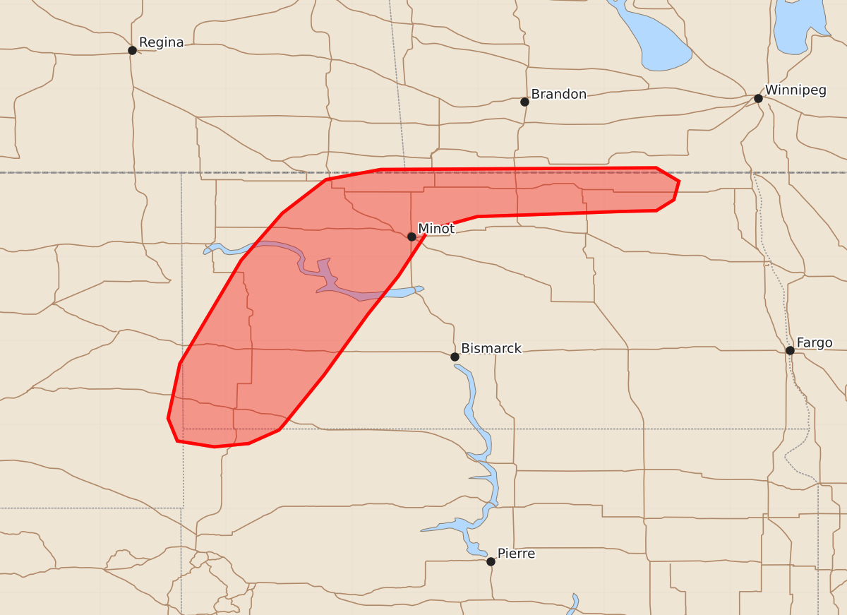
Summary
Severe thunderstorms capable of producing large hail and damaging winds will affect western to north-central North Dakota through the evening. An isolated supercell may also bring severe hail along the international border during this period.
Product Text
000 ACUS11 KWNS 052320 SWOMCD SPC MCD 052320 NDZ000-SDZ000-MTZ000-060115- Mesoscale Discussion 1516 NWS Storm Prediction Center Norman OK 0620 PM CDT Sun Jul 05 2026 Areas affected...Western to north-central North Dakota Concerning...Severe Thunderstorm Watch 464... Valid 052320Z - 060115Z The severe weather threat for Severe Thunderstorm Watch 464 continues. SUMMARY...Thunderstorms are gradually intensifying across western North Dakota and should begin to pose a severe hail/wind risk for the next several hours. A persistent supercell along the international border may also pose a more isolated severe risk through late evening. DISCUSSION...MRMS imagery and lightning counts depict gradual intensification of thunderstorms along a surface trough across western ND. Based on vertically integrated ice and MESH data, some of the deeper cores are becoming sufficiently intense to pose a severe hail risk, and the early stages of mid-level rotation are noted in KBIS velocity imagery. These signs all suggest that the potential for severe hail is gradually increasing, and will likely persist for the next few hours downstream. Based on latest RAP mesoanalyses, the best potential for significant (2 inch) hail remains along and north of the Highway 23 corridor where slightly richer low-level moisture will likely support deeper/more robust updrafts capable of realizing the strong vertical shear over the region. Further south, more dry and deeply-mixed low-level profiles may favor a slightly greater severe wind threat. Further east, and north of the international border, an isolated supercell has demonstrated significant deviant motion at times to the southeast. While deviant motion has waned in the past 30 minutes (coincident with decreasing lightning counts and a slight weakening trend), the cell continues to move across a buoyant and moderately sheared environment that may support further southward propagation. If this occurs, an isolated hail threat will likely materialize along the ND side of the border, but should remain sufficiently isolated to preclude watch issuance. ..Moore.. 07/05/2026 ...Please see www.spc.noaa.gov for graphic product... ATTN...WFO...FGF...BIS...UNR...BYZ...GGW... LAT...LON 46010280 45930287 45770323 45730364 45800408 46070419 46720405 47950332 48510283 48910231 49030166 49059838 48899811 48679817 48549838 48539882 48509962 48470051 48310109 47760145 47310181 46590233 46010280 MOST PROBABLE PEAK WIND GUST...55-70 MPH MOST PROBABLE PEAK HAIL SIZE...1.50-2.50 IN