Mesoscale Discussion 1347
Issued: · Valid: –
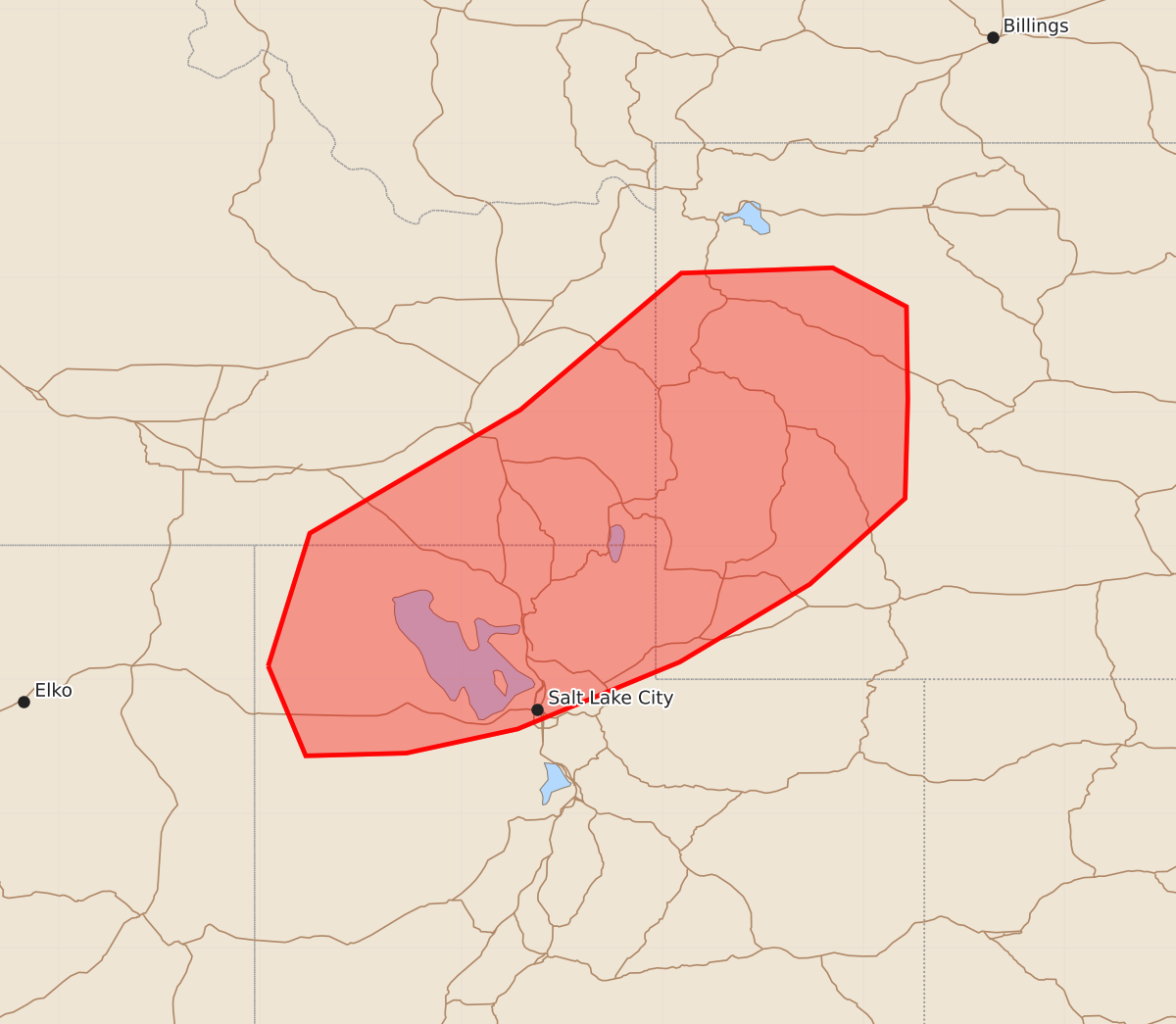
Summary
Isolated severe thunderstorms capable of producing large hail and strong wind gusts are expected across northern Utah, southeast Idaho, and western Wyoming from late morning through early afternoon.
Product Text
000 ACUS11 KWNS 271527 SWOMCD SPC MCD 271526 WYZ000-UTZ000-IDZ000-271800- Mesoscale Discussion 1347 NWS Storm Prediction Center Norman OK 1026 AM CDT Sat Jun 27 2026 Areas affected...northern Utah...southeast Idaho...and western Wyoming Concerning...Severe potential...Watch unlikely Valid 271526Z - 271800Z Probability of Watch Issuance...20 percent SUMMARY...The potential for a few severe storms capable of strong wind gusts and large hail is expected to increase by late morning into early afternoon. The current expectation is that severe weather coverage will remain too isolated to warrant a watch issuance. DISCUSSION...Within the left exit region of mid/upper-level wind maxima propagating through the Sierra Nevada into the Great Basin, a fairly long-lived cluster of thunderstorms has persisted this morning across north-central into northeast NV. Downstream from that convection, a fairly moist air mass is currently being observed across northern UT with dewpoints in the 40s to low 50s. The moisture combined with steep mid-level lapse rates is already contributing to MLCAPE as high as 500 J/kg across portions of northern UT as of 15Z. Additional destabilization is anticipated through the remainder of the morning into afternoon with the continued warming of the boundary layer. Consistent with current observational data, latest convection- allowing model guidance suggests a climatologically early increase in severe storm potential, initially across northern UT and southeast ID with activity subsequently spreading into western WY. Steadily strengthening mid/upper-level winds will result in sufficiently strong vertical shear for transient supercell and bowing structures capable of isolated occurrences of severe wind gusts and large hail. ..Mead/Guyer.. 06/27/2026 ...Please see www.spc.noaa.gov for graphic product... ATTN...WFO...RIW...SLC...PIH... LAT...LON 41101394 42091363 43011206 44031086 44070973 43780918 43090917 42350919 41710990 41131087 40631208 40451291 40431366 41101394 MOST PROBABLE PEAK WIND GUST...55-70 MPH MOST PROBABLE PEAK HAIL SIZE...UP TO 1.25 IN