Watch 464 Outline
Issued:
Summary
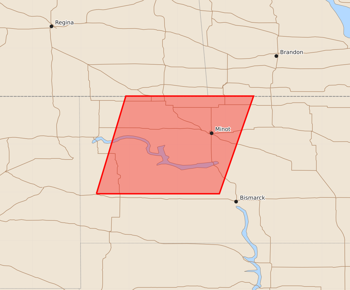
A severe thunderstorm watch is in effect for portions of north central North Dakota, including areas near Garrison and Minot, until 1:00 AM EDT. Expected hazards include up to 2-inch hail and wind gusts of 60 knots.
Product Text
000 WWUS30 KWNS 052025 SAW4 SPC AWW 052025 WW 464 SEVERE TSTM ND 052030Z - 060400Z AXIS..60 STATUTE MILES EAST AND WEST OF LINE.. 65SW N60/GARRISON ND/ - 55NNW MOT/MINOT ND/ ..AVIATION COORDS.. 50NM E/W /17ENE DIK - 48NNW MOT/ HAIL SURFACE AND ALOFT..2 INCHES. WIND GUSTS..60 KNOTS. MAX TOPS TO 500. MEAN STORM MOTION VECTOR 25030. LAT...LON 46970368 49000307 49000042 46970113 THIS IS AN APPROXIMATION TO THE WATCH AREA. FOR A COMPLETE DEPICTION OF THE WATCH SEE WOUS64 KWNS FOR WOU4.