Mesoscale Discussion 1169
Issued: · Valid: –
Summary
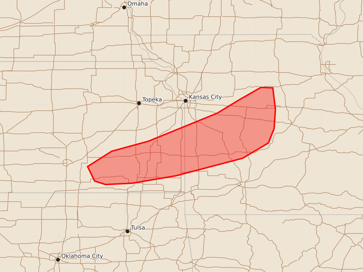
Severe thunderstorms capable of producing large hail, damaging winds, and tornadoes will impact southeast Kansas into western and central Missouri through the early evening. The threat includes potential tornadoes with winds up to 125 mph and very large hail.
Product Text
000 ACUS11 KWNS 172244 SWOMCD SPC MCD 172243 MOZ000-KSZ000-172345- Mesoscale Discussion 1169 NWS Storm Prediction Center Norman OK 0543 PM CDT Wed Jun 17 2026 Areas affected...Southeast KS into parts of western/central MO Concerning...Tornado and Severe Thunderstorm Watches 343...345... Valid 172243Z - 172345Z The severe weather threat for Tornado and Severe Thunderstorm Watches 343, 345 continues. SUMMARY...Supercells with severe hail/wind potential will continue into early evening. Some tornado potential is also evident, especially across western and central Missouri. DISCUSSION...Several discrete supercells have developed from extreme east-central KS into western/central MO late this afternoon. While this convection is developing in the vicinity of a cold front, moderate to strong deep-layer shear generally orthogonal to the boundary will continue to support semi-discrete convection into early evening, with a continued supercell threat. While midlevel temperatures are rather warm (especially with westward extent), MLCAPE of 3000-4000 J/kg and elongated mid/upper-level hodographs will support potential for large to very large hail. Localized severe gusts will also be possible. There is also an increasing concern for a tornado threat, especially across parts of western/central MO. While low-level flow is veered, some enlargement to low-level hodographs is still noted on regional VWPs and point forecast soundings, with 0-1 km SRH of near/above 150 m2/s2 sufficient to support some tornado potential, given the favorable buoyancy and low-level moisture. As a result, a Tornado Watch was recently issued to cover this potential tornado threat. ..Dean.. 06/17/2026 ...Please see www.spc.noaa.gov for graphic product... ATTN...WFO...LSX...SGF...EAX...TOP...ICT... LAT...LON 38189545 38829388 39139337 39419288 39409261 38919255 38479258 38149271 37799330 37399482 37229582 37199643 37279668 37609684 37959629 38189545 MOST PROBABLE PEAK TORNADO INTENSITY...100-125 MPH MOST PROBABLE PEAK WIND GUST...65-80 MPH MOST PROBABLE PEAK HAIL SIZE...2.00-3.50 IN