Mesoscale Discussion 1230
Issued: · Valid: –
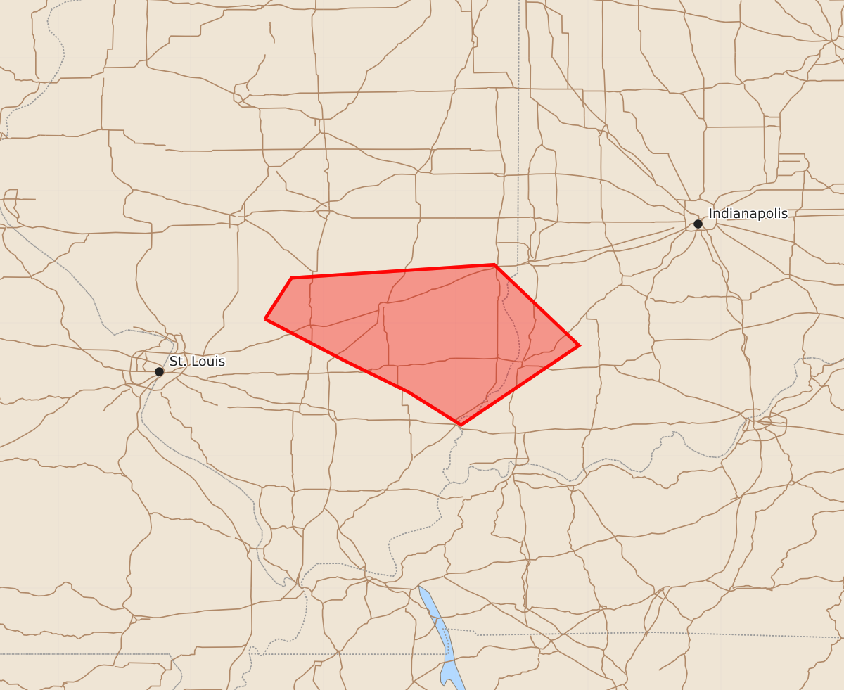
Summary
A risk of strong tornadoes exists for parts of southeastern Illinois and southwestern Indiana between 4 PM and 6 PM CDT this afternoon.
Product Text
000 ACUS11 KWNS 211934 SWOMCD SPC MCD 211934 INZ000-ILZ000-212130- Mesoscale Discussion 1230 NWS Storm Prediction Center Norman OK 0234 PM CDT Sun Jun 21 2026 Areas affected...parts of south central/ southeastern Illinois and adjacent southwestern Indiana Concerning...Tornado Watch 363... Valid 211934Z - 212130Z The severe weather threat for Tornado Watch 363 continues. SUMMARY...The potential for one or two strong tornadoes may begin to maximize with evolving supercell structures across parts of southeastern Illinois, generally centered around the Effingham vicinity, by 4-6 PM CDT. DISCUSSION...Two-hourly surface pressure falls on the order of 2+ mb have become focused along a corridor from Litchfield through Effingham and Lawrenceville, southwestward toward Mt. Vernon, downstream of the remnant eastward migrating MCV. Boundary-layer dew points are approaching 70F across this region, contributing to thermodynamic profiles with sizable buoyancy rooted near the surface. Coupled with enlarging, clockwise-curved low-level hodographs beneath 30-50 south to southwesterly 850-500 mb flow overspreading the region, the environment appears to be coming increasingly conducive to the evolution of supercell structures posing a risk for tornadoes. Given the potential for concentrating ambient vertical vorticity, coupled with potentially strong near-surface upward accelerations, a strong tornado or two appears possible. ..Kerr.. 06/21/2026 ...Please see www.spc.noaa.gov for graphic product... ATTN...WFO...IND...PAH...ILX...LSX... LAT...LON 39038944 39348924 39448771 38838707 38238796 38488836 38718883 39038944