Mesoscale Discussion 1558
Issued: · Valid: –
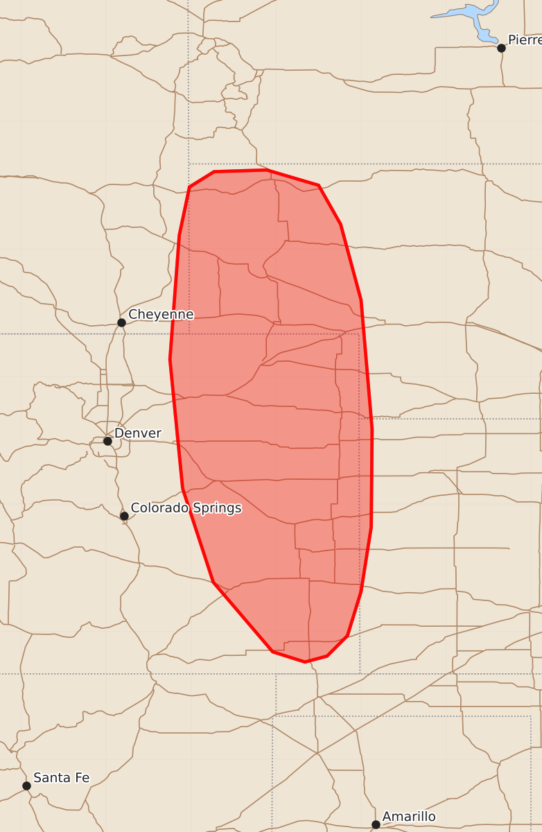
Summary
Developing thunderstorms across portions of the central High Plains may bring severe wind gusts and large hail this afternoon and evening. These storms are expected to increase in coverage and organization, potentially resulting in wind gusts of 65-80 mph and hail up to 1.75 inches.
Product Text
000 ACUS11 KWNS 091939 SWOMCD SPC MCD 091939 NEZ000-KSZ000-COZ000-WYZ000-092145- Mesoscale Discussion 1558 NWS Storm Prediction Center Norman OK 0239 PM CDT Thu Jul 09 2026 Areas affected...portions of the central High Plains Concerning...Severe potential...Severe Thunderstorm Watch likely Valid 091939Z - 092145Z Probability of Watch Issuance...80 percent SUMMARY...Developing thunderstorms will evolve eastward off of the high-terrain of southeastern Wyoming and central Colorado this afternoon and evening, bringing a risk for damaging/severe wind gusts and large hail. DISCUSSION...Aided by forcing for ascent ahead of a subtle mid-level perturbation and southeasterly upslope flow, ongoing thunderstorm development across the central Rockies and Laramie Range is expected to increase in coverage through the afternoon, with deep-layer westerly flow aloft yielding an eastward progression of developing convection. Steepening low-level lapse rates and dry, well-mixed boundary layer profiles will favor efficient evaporative cooling and an amalgamation of cold pools, with gradual upscale growth into one or more linear clusters/segments and an increase in the threat for damaging/severe wind gusts expected into this evening. Given the presence of a surface moisture gradient (dewpoints in the 40s to low 50s F near the Foothills increasing into the low-to-mid 60s in western Kansas/Nebraska) and only modest effective shear of 25-30 kts, storm organization/intensification may occur relatively slowly as storms progress eastward. Thus, while one or more Severe Thunderstorm Watches will likely be needed later this afternoon/evening, the timing of watch issuance remains uncertain pending the increase in storm organization and the attendant severe risk. ..Chalmers/Hart.. 07/09/2026 ...Please see www.spc.noaa.gov for graphic product... ATTN...WFO...LBF...DDC...GLD...PUB...BOU...CYS... LAT...LON 39180410 40700425 42160414 42730402 42910373 42930311 42750250 42290224 41400200 39880187 38730188 37970200 37450216 37210240 37140266 37260304 38080374 39180410 MOST PROBABLE PEAK WIND GUST...65-80 MPH MOST PROBABLE PEAK HAIL SIZE...1.00-1.75 IN