Mesoscale Discussion 2272
Issued: · Valid: –
Summary
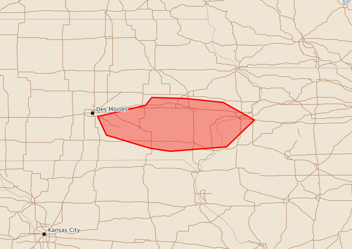
A cluster of storms may bring severe wind and hail to parts of south central and southeastern Iowa through late evening. These storms are expected to weaken as they move toward the Mississippi River by 10-11 PM CDT.
Product Text
000 ACUS11 KWNS 090034 SWOMCD SPC MCD 090033 ILZ000-IAZ000-090230- Mesoscale Discussion 2272 NWS Storm Prediction Center Norman OK 0733 PM CDT Tue Sep 08 2026 Areas affected...parts of south central and southeastern Iowa Concerning...Severe potential...Watch unlikely Valid 090033Z - 090230Z Probability of Watch Issuance...20 percent SUMMARY...A loosely organized cluster of storms may continue to pose a risk for severe wind and hail another hour or two, but seems likely to weaken as it approaches the southeastern Iowa Mississippi River vicinity toward 10-11 PM CDT. At this point a severe weather watch is not anticipated, but trends will continue to be monitored. DISCUSSION...A strong downburst, and perhaps an associated developing meso-beta scale cyclonic circulation, associated with intensifying convection initially above/to the cool side of a fairly sharp low-level baroclinic zone, overtook the boundary across and east of the Des Moines area 1-2 hours ago. This remains the case as activity propagates east-southeastward near and to the northeast of the Knoxville IA vicinity. Probably initially supported by an influx of seasonably moist boundary-layer air characterized by CAPE on the order of 2000-3000 J/kg, it remains unclear how long this will be maintained into this evening. There has been some recent increase in surface dew points along/just ahead of the convection and wave along the boundary, accompanied by an increase in initially more modest CAPE toward the Mississippi River. However, with little in the way of cooling aloft, and at least gradually surface cooling underway, it remains unclear how long large-scale and mesoscale ascent will overcome increasing inhibition. ..Kerr/Gleason.. 09/09/2026 ...Please see www.spc.noaa.gov for graphic product... ATTN...WFO...DVN...DMX... LAT...LON 41519351 41749253 41909240 41889172 41809094 41449030 40899087 40809202 40869243 41139333 41519351 MOST PROBABLE PEAK TORNADO INTENSITY...UP TO 90 MPH MOST PROBABLE PEAK WIND GUST...55-70 MPH MOST PROBABLE PEAK HAIL SIZE...1.00-1.75 IN