Day 3 Convective Outlook
This product has been superseded. View the updated product →
Issued: · Valid: –
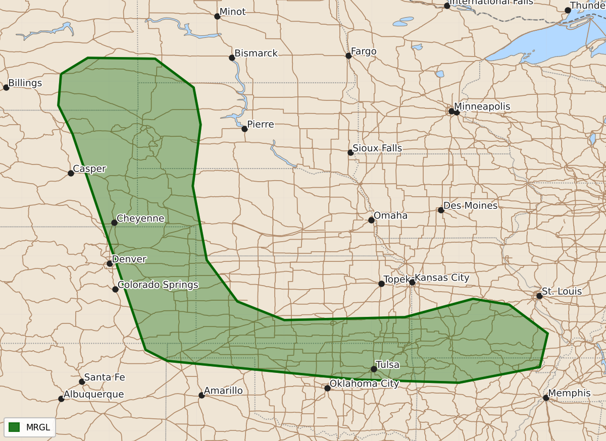
Summary
Isolated severe thunderstorms capable of producing large hail and strong wind gusts are possible across the High Plains, southern Kansas, northern Oklahoma, and the Ozarks on Friday.
Product Text
000 ACUS03 KWNS 240722 SWODY3 SPC AC 240721 Day 3 Convective Outlook NWS Storm Prediction Center Norman OK 0221 AM CDT Wed Jun 24 2026 Valid 261200Z - 271200Z ...THERE IS A MARGINAL RISK OF SEVERE THUNDERSTORMS ACROSS PORTIONS OF THE HIGH PLAINS AND SOUTHERN KANSAS AND NORTHERN OKLAHOMA INTO THE OZARKS.... ...SUMMARY... Isolated severe storms capable of large hail and severe wind gusts will be possible across the High Plains and across southern Kansas and northern Oklahoma into southern Missouri and northern Arkansas on Friday. ...Synopsis... A strong mid-level shortwave trough will move from the eastern Pacific into the Northwest CONUS on Friday with the trough continuing to deepen through the period. An elongated mid-level jet streak will stretch from the California coast to the northern Plains by 12Z Saturday. Surface low pressure will exist across the Inter-Mountain West as this trough amplifies and will eventually consolidate as a lee cyclone across the northern Plains by the end of the period. ...High Plains... Moderate to strong instability is forecast across the High Plains on Friday as a dryline develops along the lee trough. Ridging should limit overall convective coverage, but with 30 to 35 knots of mid-level flow, isolated supercells are possible with a threat for large hail and severe wind gusts. ...Southern Kansas and northern Oklahoma into the Ozarks... Strong instability is forecast along a frontal boundary that will exist from the OK/KS border into southern Missouri where dewpoints will be in the low to mid 70s. Upper-level forcing will be weak, with neutral to perhaps slightly rising heights. Therefore, the strong instability and forecast soundings showing an uncapped airmass near a frontal zone will support the potential for strong to severe storms Friday afternoon/evening. In addition, the low-level jet is forecast to strengthen Friday evening which may provide additional support for storm development, even if it doesn't occur during daytime heating. ..Bentley.. 06/24/2026 $$