Day 3 Convective Outlook
This product has been superseded. View the updated product →
Issued: · Valid: –
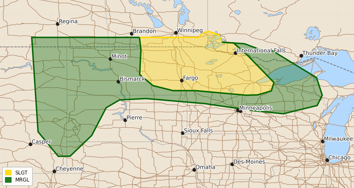
Summary
Severe thunderstorms capable of producing large hail and damaging winds are possible across the northern Plains and into parts of the Upper Midwest on Sunday.
Product Text
000 ACUS03 KWNS 260728 SWODY3 SPC AC 260727 Day 3 Convective Outlook NWS Storm Prediction Center Norman OK 0227 AM CDT Fri Jun 26 2026 Valid 281200Z - 291200Z ...THERE IS A SLIGHT RISK OF SEVERE THUNDERSTORMS FROM EASTERN NORTH DAKOTA INTO NORTHERN MINNESOTA AND NORTHWEST WISCONSIN... ...SUMMARY... Severe thunderstorms are possible from the northern Plains into parts of the Upper Midwest on Sunday. Large hail and severe winds are the primary hazards. ...Eastern North Dakota into Minnesota... Some convection is expected to be ongoing during the early morning in eastern North Dakota. Given the time of day, it is not clear how intense this activity will be, but some risk for damaging winds/large hail may exist. With time, a plume of rich surface moisture and steep mid-level lapse rates will lift northward as the upper ridge builds in the Midwest. The morning activity may be able to intensify as is moves into northern Minnesota/northern Wisconsin. While there remains some uncertainty in the exact evolution, the Slight Risk has been shifted eastward to account for this potential. ...Northern Plains... Convection is possible during the late evening as another shortwave pivots into the High Plains and a surface low deepens in the lee of the Rockies. The position of this shortwave is not certain. The ECMWF shows the surface low developing in the central High Plains while the NAM suggest this will occur farther north into Nebraska/South Dakota. In either case, steep mid-level lapse rates, strong deep-layer winds, and adequate buoyancy will support a risk of large hail and isolated severe gusts during late evening into parts of the overnight. ...Midwest into Tennessee Valley Vicinity... Models suggest potential for an MCV to move southeastward through the day. The position of this feature varies substantially between models, however, and it will depend on if/how much convection develops late Saturday night. Marginal severe probabilities may be needed if confidence on the location of the MCV increases. ..Wendt.. 06/26/2026 $$