Day 3 Convective Outlook
This product has been superseded. View the updated product →
Issued: · Valid: –
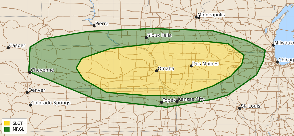
Summary
Severe thunderstorms capable of producing large hail and damaging wind gusts are expected Tuesday afternoon and evening across parts of the central Plains to the Mid-Mississippi Valley.
Product Text
000 ACUS03 KWNS 160719 SWODY3 SPC AC 160719 Day 3 Convective Outlook CORR 1 NWS Storm Prediction Center Norman OK 0219 AM CDT Sun Aug 16 2026 Valid 181200Z - 191200Z ...THERE IS A SLIGHT RISK OF SEVERE THUNDERSTORMS ACROSS PARTS OF THE CENTRAL PLAINS TO THE MID-MISSISSIPPI VALLEY... CORRECTED FOR MISSPELLING ...SUMMARY... Severe thunderstorms capable of large hail and damaging wind gusts are expected on Tuesday afternoon/evening across parts of the central Plains to the Mid-Mississippi Valley. ...Central Plains to Mid-MS Valley vicinity... Height falls are expected across the region during the afternoon into Tuesday night as an upper trough continues to dig across the Great Lakes. This will result in increasing northwesterly flow aloft, and a deepening surface low over KS. Rich boundary layer moisture will be in place ahead of a south/southeast-advancing cold front. Moderate to strong instability is expected to develop by afternoon. Forecast soundings show steep midlevel lapse rates, with vertically veering wind profiles supporting 40+ kt effective shear. Elongated/straight hodographs are also present in forecast soundings. Initial supercells could pose a risk for large hail and severe gusts. With time, sufficient clustering could occur ahead of the front as a low-level jet increases during the evening, and MCS development may occur. ..Leitman.. 08/16/2026 $$