Day 3 Convective Outlook
This product has been superseded. View the updated product →
Issued: · Valid: –
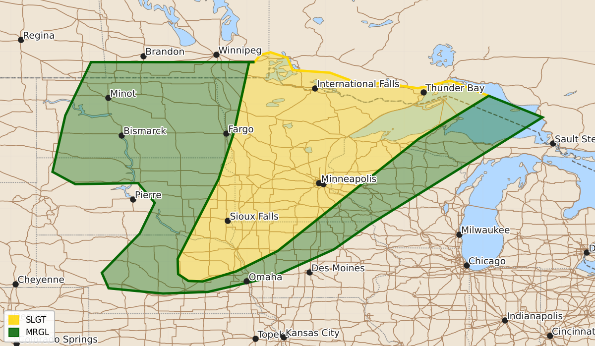
Summary
Severe thunderstorms capable of producing large hail and strong winds are possible across the central and northern Plains into the Upper Midwest on Monday.
Product Text
000 ACUS03 KWNS 270731 SWODY3 SPC AC 270730 Day 3 Convective Outlook NWS Storm Prediction Center Norman OK 0230 AM CDT Sat Jun 27 2026 Valid 291200Z - 301200Z ...THERE IS A SLIGHT RISK OF SEVERE THUNDERSTORMS FROM THE MID-MISSOURI VALLEY INTO THE UPPER MIDWEST... ...SUMMARY... Severe thunderstorms are possible from parts of the central/northern Plains into the Upper Midwest on Monday. Large hail and severe winds are the primary concerns. ...Central/northern Plains into the Upper Midwest... A shortwave trough is expected to eject into the Dakotas and the Upper Midwest. The timing and evolution of this feature varies in model guidance. The ECMWF suggests a later and a more eastward-moving wave ejection as compared to the earlier, meridional trajectory of the NAM/GFS. These differences lead to drastic differences in where convection will ultimately form. The farther north solutions show little in the way of convection as compared to the ECMWF. A very moist airmass will be in place along with steep mid-level lapse rates overspreading the area. The amplified ridge in the East will remain in place and will suppress thunderstorm potential away from the trough/cold front. Models all suggest extreme buoyancy (4500+ J/kg MLCAPE) will develop within the warm sector. Deep-layer shear will be strong enough for organized storms. Given the potential for intense storms, a broad Slight will be maintained with the caveat that convective development is somewhat conditional/uncertain. ..Wendt.. 06/27/2026 $$