Day 1 Convective Outlook
This product has been superseded. View the updated product →
Issued: · Valid: –
Summary
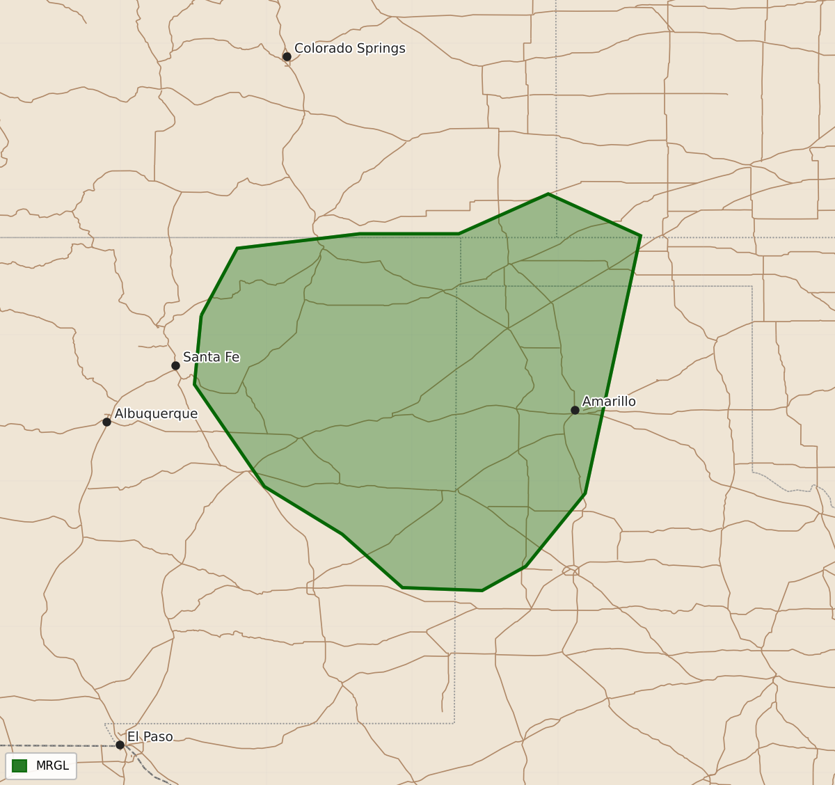
Severe thunderstorms capable of producing large hail and strong winds may impact northeastern New Mexico and adjacent high plains late this afternoon into the evening.
Product Text
000 ACUS01 KWNS 150528 SWODY1 SPC AC 150527 Day 1 Convective Outlook NWS Storm Prediction Center Norman OK 1227 AM CDT Mon Jun 15 2026 Valid 151200Z - 161200Z ...THERE IS A MARGINAL RISK OF SEVERE THUNDERSTORMS THIS AFTERNOON AND EVENING ACROSS PARTS OF THE SOUTHERN HIGH PLAINS... ...SUMMARY... Strong thunderstorm activity may impact the higher terrain of northeastern New Mexico into adjacent high plains late this afternoon into evening, accompanied by at least some potential for severe hail and wind. ...Discussion... Higher latitude blocking appears likely to persist with little general change through this period. This regime will maintain a broad area of cyclonic flow with anomalously low heights, which may deepen further to the south of the central and eastern Canadian/U.S. border vicinity, as a significant short wave trough digs across the Dakotas through portions of the Upper Midwest by 12Z Tuesday. Models indicate that this is likely to be accompanied by a more notable southward surge of cooler/drier air, in the wake of a stalling, weakening preceding cold front reaching the southern Atlantic/Gulf Coast vicinity. With higher boundary-layer moisture content and stronger potential instability largely becoming confined to the south of the westerlies, the potential for organized severe thunderstorm development appears seasonably low today through tonight. ...Southern Rockies into adjacent Great Plains... Beneath a northwesterly mid-level regime, which may modestly strengthen to the southwest of the digging short wave trough by this late afternoon, models indicate that moistening on southerly low-level flow may contribute to modest destabilization across the eastern/southeastern slopes of the southern Sangre de Cristo Mountains into Raton Mesa vicinity. Perhaps aided by forcing for ascent accompanying a subtle digging short wave perturbation, it appears possible that thunderstorm activity, initiating with destabilization across the higher terrain, could consolidate into a small organizing cluster while propagating southeastward into the adjacent high plains. Forecast soundings across this region suggest that thermodynamic profiles may become potentially conducive to the development of large hail and strong to severe wind gusts into mid to late evening. ..Kerr/Weinman.. 06/15/2026 $$