Mesoscale Discussion 1107
This product has been superseded. View the updated product →
Issued: · Valid: –
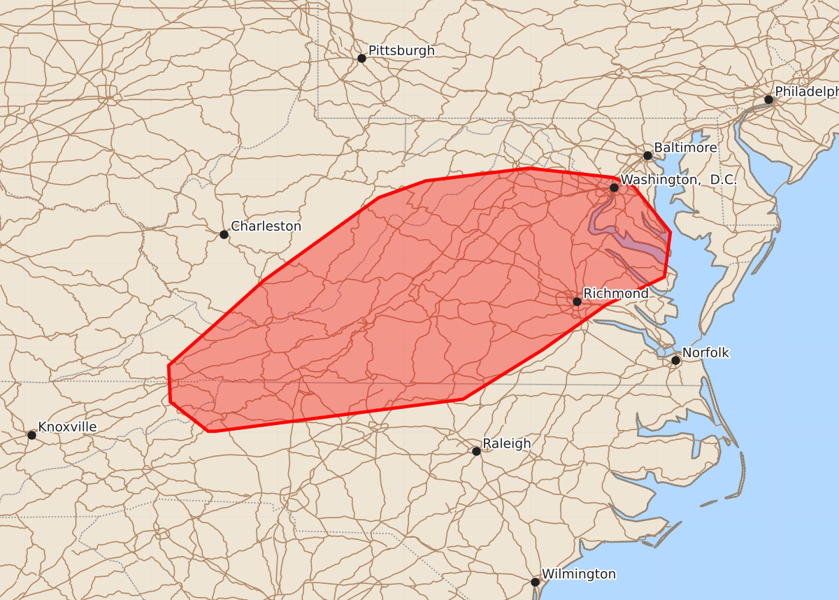
Summary
Scattered storms capable of producing damaging wind gusts of 55 to 70 mph are expected to develop throughout much of Virginia, parts of West Virginia, Maryland, and northern North Carolina this afternoon.
Product Text
000 ACUS11 KWNS 121758 SWOMCD SPC MCD 121757 VAZ000-MDZ000-DCZ000-NCZ000-WVZ000-TNZ000-121900- Mesoscale Discussion 1107 NWS Storm Prediction Center Norman OK 1257 PM CDT Fri Jun 12 2026 Areas affected...much of Virginia...parts of West Virginia...Maryland...northern North Carolina Concerning...Severe potential...Watch likely Valid 121757Z - 121900Z Probability of Watch Issuance...80 percent SUMMARY...Scattered storms capable of damaging wind gusts are expected to develop through the afternoon. DISCUSSION...A surface trough is gradually deepening across MD/VA/NC with strong heating resulting in very steep low-level lapse rates. Modest northwest flow aloft exists into the area, which may aid in steering storms in a southeastward direction. Visible imagery shows a moist air mass across the entire area and extending west across the higher terrain as well, suggesting minimal drying/downslope effects. In the next couple hours, storms may form in the agitated CU area currently seen over northern into northwest VA. Several models depict a possible cluster of storms moving southeastward later today, with a corridor of damaging winds possible. Other storms are likely to develop over WV and southward across the Appalachians. Given the weak northwest winds aloft, any such activity may move into the lower terrain late in the day. Several models suggest any such convection and/or outflows may instigate new development during the later afternoon into much of central VA and perhaps northern NC. ..Jewell/Thompson.. 06/12/2026 ...Please see www.spc.noaa.gov for graphic product... ATTN...WFO...AKQ...LWX...RAH...RNK...RLX...GSP...MRX... LAT...LON 37258177 37808116 38787980 38987924 39137802 39027702 38927678 38377634 37847641 37517710 36987785 36397880 36018174 36018182 36368227 36798229 37258177 MOST PROBABLE PEAK WIND GUST...55-70 MPH MOST PROBABLE PEAK HAIL SIZE...UP TO 1.25 IN