Day 3 Convective Outlook
This product has been superseded. View the updated product →
Issued: · Valid: –
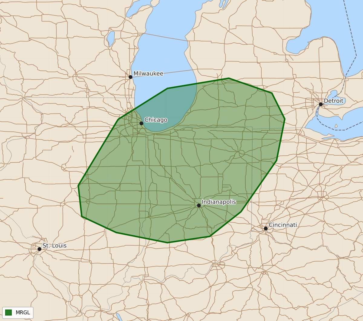
Summary
Isolated strong to severe thunderstorms are possible across parts of the Midwest on Tuesday afternoon and evening, primarily bringing hazards of gusty winds and hail.
Product Text
000 ACUS03 KWNS 140612 SWODY3 SPC AC 140611 Day 3 Convective Outlook NWS Storm Prediction Center Norman OK 0111 AM CDT Sun Jun 14 2026 Valid 161200Z - 171200Z ...THERE IS A MARGINAL RISK OF SEVERE THUNDERSTORMS ACROSS PARTS OF THE MIDWEST... ...SUMMARY... Isolated strong to severe thunderstorms are possible Tuesday afternoon and evening across parts of the Midwest. ...Midwest... An upper shortwave trough over the MO Valley will develop eastward across the Upper Great Lakes/Midwest on Tuesday. A stalled surface front across the Gulf Coast region will suppress boundary-layer moisture across the Midwest. Surface dewpoints are forecast to generally be in the mid 50s to low 60s amid steepening midlevel lapse rates. This will support MLCAPE up to 1500 J/kg across portions of the Mid-MS Valley to Lake Michigan vicinity. A weak surface low is forecast to move across WI/Lower MI and a trailing front will move across IL/IN and vicinity. Isolated to scattered thunderstorms are expected during the afternoon. Sufficient shear will exist for organized storms, with 30-40 kt midlevel flow depicted in forecast soundings. Gusty winds and hail will be the main hazards with this activity during the afternoon and evening. Severe potential will diminish with eastward extent due to decreasing boundary layer moisture and weakening instability toward the Ohio Valley. ..Leitman.. 06/14/2026 $$