Day 2 Convective Outlook
This product has been superseded. View the updated product →
Issued: · Valid: –
Summary
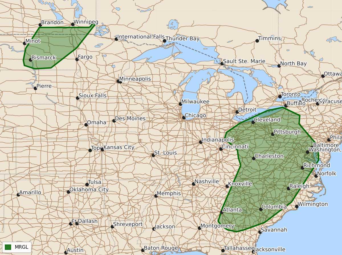
Isolated severe thunderstorms capable of producing damaging winds are possible from the upper Ohio Valley through the Carolinas and parts of Georgia during Sunday afternoon and evening. A marginal risk of severe storms including large hail and damaging winds exists across parts of North Dakota and northwest Minnesota late Sunday night.
Product Text
000 ACUS02 KWNS 010527 SWODY2 SPC AC 010525 Day 2 Convective Outlook NWS Storm Prediction Center Norman OK 1225 AM CDT Sat Aug 01 2026 Valid 021200Z - 031200Z ...THERE IS A MARGINAL RISK OF SEVERE THUNDERSTORMS FROM THE UPPER OHIO VALLEY INTO THE CAROLINAS AND PARTS OF GEORGIA...AND OVER A PART OF THE NORTHERN PLAINS... ...SUMMARY... Isolated occurrences of mainly damaging winds are possible from the upper Ohio Valley into the Carolinas and parts of Georgia Sunday afternoon and evening. A more conditional severe risk exists across parts of North Dakota into far northwest Minnesota late Sunday night. ...Synopsis... A mid-level low initially over the lower OH Valley Sunday morning is forecast to evolve into an open wave while slowly moving through the OH and TN Valleys. That feature will be loosely linked to a strengthening mid-level trough over eastern ON into QC. Elsewhere, an intense upper low will move from AB into SK with an attending belt of 50-70 kt winds at 500 mb spreading from the northern Rockies into the northern High Plains. At the surface, an area of low pressure will move through the OH Valley with a trailing wind shift/weak front moving across the TN Valley and Gulf Coast states. There is also a signal for a diffuse warm front to lift north through the Mid-Atlantic and southern New England. Farther northwest, a cold front will advance into the northern Plains. ...Upper Ohio Valley into the Southeast... Showers and thunderstorms are expected to be ongoing Sunday morning from the lower Great Lakes into the central Appalachians within the warm-conveyor air stream preceding the OH Valley low. The presence of a moist and at least modestly unstable environment with little to no capping will allow showers and storms to persist through the day in some areas. Where cloud breaks can occur, increased daytime heating will support corridors of MLCAPE up to 1000-1500 J/kg. More intense storms appear possible during the afternoon within the areas of greater instability, from near and east of the surface low in the upper OH Valley south along and ahead of the front into GA. The strongest deep-layer shear of 30-35 kt is forecast near the surface low, where some storm organization appears possible, given sufficient destabilization. Another area of potential interest is along the diffuse warm front, which is forecast to lift through the southern Mid-Atlantic during the late afternoon into evening. While deep-layer shear will be somewhat limited, locally backed surface winds combined with a broadening and strengthening low-level jet may enhance low-level shear in the vicinity of the boundary. Locally damaging wind gusts appear to be the primary hazard with the most intense storms during the afternoon into evening. However, a brief tornado cannot be ruled out near the warm front. The probability of that occurrence currently appears to be less than 2%. ...Northern Plains... While boundary-layer moisture content will remain somewhat limited, the presence of steep low/mid-level lapse rates is expected to yield an axis of moderate instability ahead the front with MLCAPE of 1000-1500 J/kg. Despite pre-frontal temperatures warming into the 90s to around 100, afternoon storm development remains uncertain due to capping at the base of an EML and the absence of forcing for ascent. Some of the 00Z models indicate a greater possibility of isolated storm development (mainly elevated) late Sunday night as the cap is gradually eroded by increasing height falls aloft. Strengthening vertical shear combined with steep mid-level lapse rates and MUCAPE of 1000-2000 J/kg suggests a conditional risk for severe storms capable of large hail and perhaps locally damaging wind gusts. The level 1/Marginal Risk will be maintained due to uncertainties in storm development and potential coverage. ..Mead.. 08/01/2026 $$